Well the season has slowly turned to fall and because we took so much time off to have fun in the summer sun, I have been looking for some smaller-scale local hiking. I am always looking for something a little less beaten and tend to just see a mountain or a trail while driving and research it when I get home. This is the case with the mountains in the Sooke Hills Wilderness Park.
While driving on the Sooke highway I noticed a lot of people parked at a mailbox just beyond the four lanes. When my fiancee and I had gone back to explore we could not find an obvious trail that didn't lead straight into someone's property... Thus, we gave up and assumed that the people parked must just be commuters... Even though I had seen a few "hikey" looking people with day packs...
Recently I was scoping out Mount Mcdonald, which I heard could be hiked, and found a trip report for a few mountains in that area. Guess what? They parked at the mailboxes! Boom! So here is a trip report for a few mountains we have hiked in the Sooke Hills Wilderness Park:
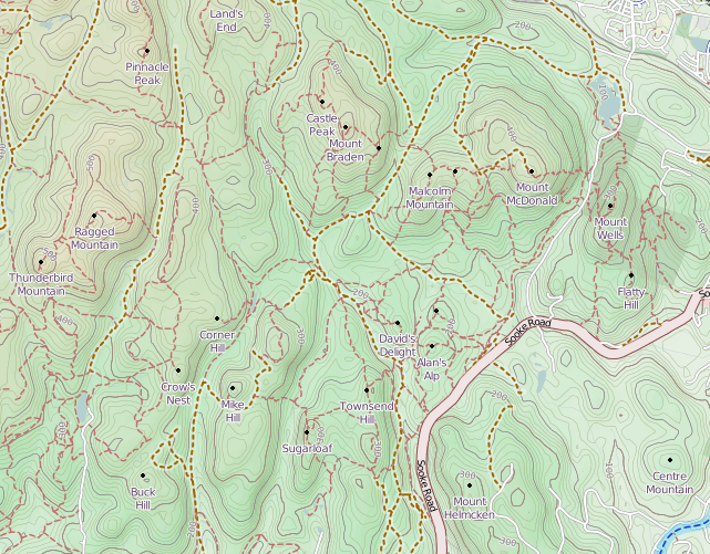
Sooke Hills: opencyclemap.org
Getting there:
Park at the pull over by the mailboxes just after the four lanes end on the Sooke Highway heading north. Walk six telephone poles south, back towards Langford, and head into the bushes on a well beaten trail passed an old bbq stand, metal fixtures, and a VW bug (obviously an old dumping area for some...). Make sure to pack a spider web stick... unless you are cool with having some new friends on your shoulder or face...
Don't get side tracked by any of the off-shoot trails, just stay headed straight for about 7-10 minutes until you hit a creek crossing made of two logs and a rope. This is Veitch Creek. After the creek crossing you will walk up a steep bank and hit a wide old skidder road-type trail (the old Veitch Main). All of the trails for this whole area are in the map above. As you can see there are a fair bit.
Sugarloaf mountain:
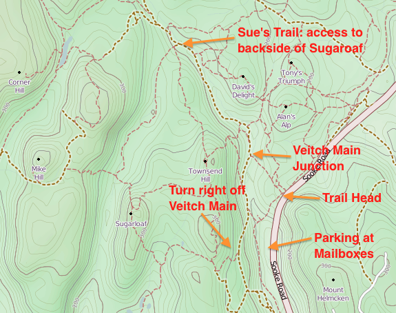
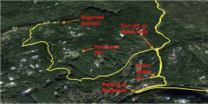
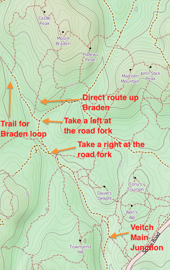
The simplest way to get to Sugarloaf is about 3.8kms from Sooke Road (7.6kms round trip) and took us about 40mins up and 35mins down. On this trip we used my new GPS to test it out. It was very helpful since this route seemed to get us (or me) a bit turned around. Basically once we hit the wide trail as stated above (listed as the Veitch Main Junction on the above below), we took a left (south) and walked on the wide path for about 5 or so minutes. We then saw a slightly flagged path that took a hard right (west) and had some old ceramic fixtures laying on the ground. We followed this up. It was steep to start, but eventually levelled off. I got a bit confused here because I did not realize that Sugarloaf was set back behind another hill called Townsend Hill, which we passed on our right.
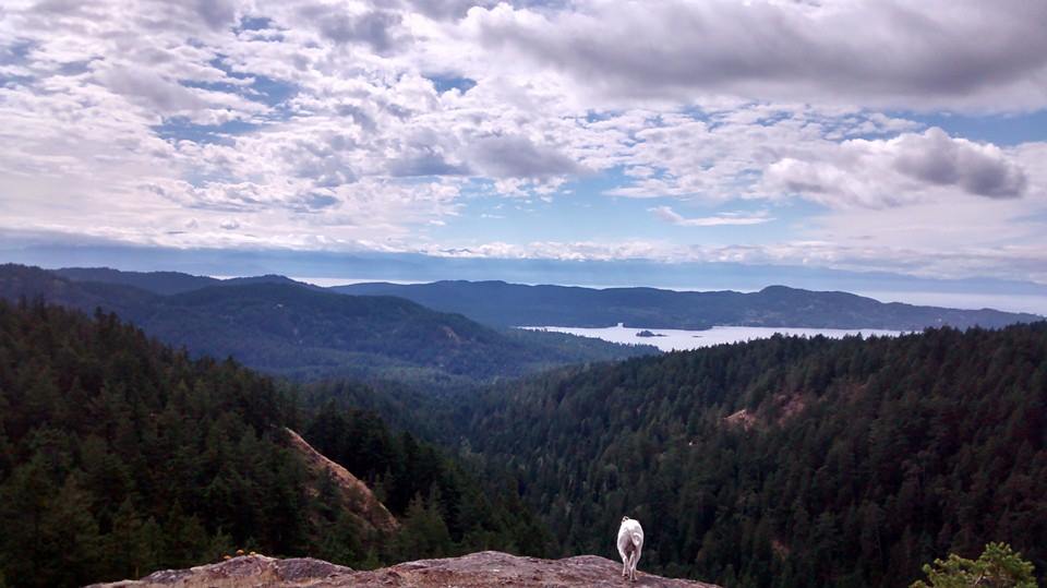
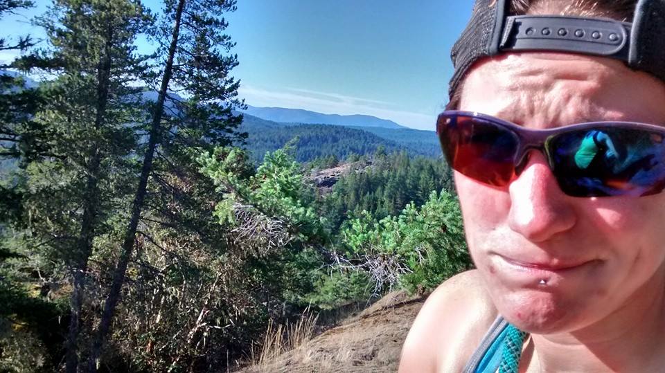
The trail continued on and even headed down for a short period. Eventually we had to take an obvious right turn off a wide trail to one a bit smaller and more rough. The trail again became steep as we finally ascended the last bit of the mountain. Near the top, the rocks were slightly scrambly and we emerged through two giant rocks onto the summit. "Bing, Bing" my GPS told us we were at the Sugarloaf's summit It was a clear and beautiful day and there were amazing views of the Sooke Basin.
Park at the pull over by the mailboxes just after the four lanes end on the Sooke Highway heading north. Walk six telephone poles south, back towards Langford, and head into the bushes on a well beaten trail passed an old bbq stand, metal fixtures, and a VW bug (obviously an old dumping area for some...). Make sure to pack a spider web stick... unless you are cool with having some new friends on your shoulder or face...
Don't get side tracked by any of the off-shoot trails, just stay headed straight for about 7-10 minutes until you hit a creek crossing made of two logs and a rope. This is Veitch Creek. After the creek crossing you will walk up a steep bank and hit a wide old skidder road-type trail (the old Veitch Main). All of the trails for this whole area are in the map above. As you can see there are a fair bit.
Sugarloaf mountain:
The simplest way to get to Sugarloaf is about 3.8kms from Sooke Road (7.6kms round trip) and took us about 40mins up and 35mins down. On this trip we used my new GPS to test it out. It was very helpful since this route seemed to get us (or me) a bit turned around. Basically once we hit the wide trail as stated above (listed as the Veitch Main Junction on the above below), we took a left (south) and walked on the wide path for about 5 or so minutes. We then saw a slightly flagged path that took a hard right (west) and had some old ceramic fixtures laying on the ground. We followed this up. It was steep to start, but eventually levelled off. I got a bit confused here because I did not realize that Sugarloaf was set back behind another hill called Townsend Hill, which we passed on our right.
The trail continued on and even headed down for a short period. Eventually we had to take an obvious right turn off a wide trail to one a bit smaller and more rough. The trail again became steep as we finally ascended the last bit of the mountain. Near the top, the rocks were slightly scrambly and we emerged through two giant rocks onto the summit. "Bing, Bing" my GPS told us we were at the Sugarloaf's summit It was a clear and beautiful day and there were amazing views of the Sooke Basin.
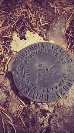 Surveyor's marker | 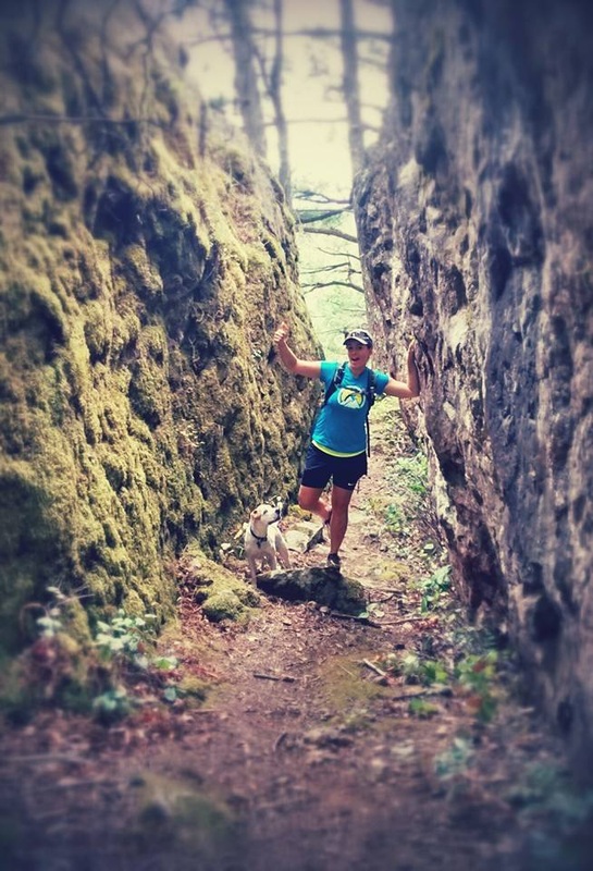 Rocks you pop up between at the summit |
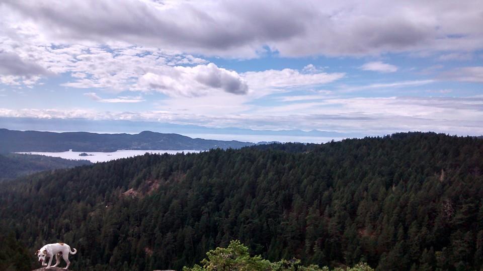
View of East Sooke
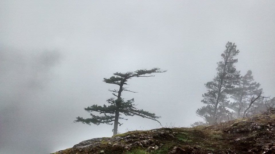
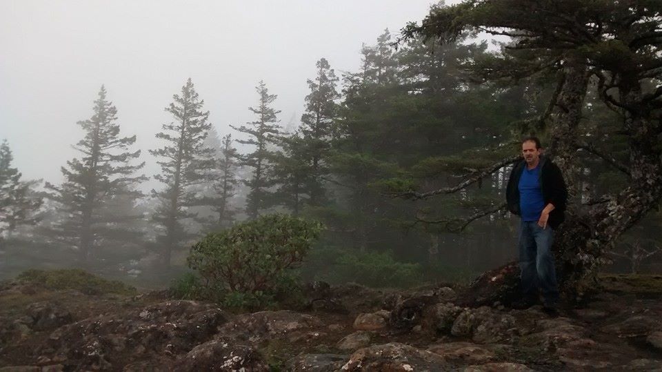
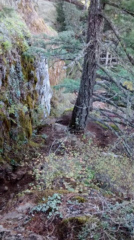
There is also a loop you can do that ascends the north side of Sugarloaf and comes down the way talked about above. It is about 9.5kms round trip and takes around 2hrs 30mins. Head right (north) at the Veitch Main junction and follow it all the way until you see a pink flagged route to the left, which is called Sue's Trail on the map above. Follow this trail way back around to the north side of Sugarloaf and eventually there is a trail that heads up the mountain off to the left of the trail. It is a pretty big loop and you may feel that you are heading off into the middle of nowhere, but there aren't many off shoot trails to confuse you. I did this route with my dad on a rainy and foggy day as you can see in the pictures below. Not the greatest views that day.
 |  |
Mount Braden:
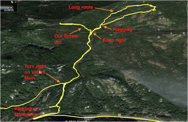
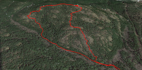
For this mountain we did the "Mount Braden Loop," which is a bit more of an investment. It is about 12.5kms round trip and took us just over 4 hours because we made a wrong turn and had to back track. I feel if we did it again we could do it in just over 3 hours. From the wide path just above Veitch Creek, we took a right and headed along with the creek down on our right for about 15-20mins. Eventually we ended up at a logging road that forked left and right, we took a right. We made the mistake of taking a small trail that branched off to the left not long after this, but thanks to the GPS I could see that we were headed in the complete opposite direction of Mount Braden and we turned around and ran back to the road.
We kept on the road, which eventually crossed over Veitch Creek so that it was on our left and then hit another fork. Here we took a left and about 300m from the fork I could see a flagging trail leading up on the right(our descent trail). Because we wanted to do the loop, we carried on passed this. After about 7mins the wide trail split and headed either left back across the creek or up to the right on a flagging trail (marked as the up route on the map above). We took the right and followed flagging on a less beaten route.
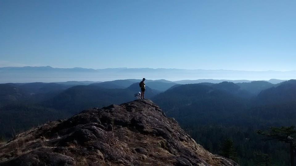
Here we had to start paying attention to flagging and my GPS indicated that we were not necessarily heading for Mount Braden, but a more round about route. We summited quite a few small bluffs, going up and down, until finally we could see the peak of Braden still a few humps over. It was a bit frustrating constantly gaining and loosing elevation, but eventually we made the final climb up the mountain. The views were amazing in all directions. Definitely worth the hike.
Heading back down we took a slightly booted and cairned route over the south face of the mountain (down route on the map above). It was much more direct and took us back down to the old road below. In total from the summit back to the truck on Sooke Rd took us an hour at a good pace.
For this mountain we did the "Mount Braden Loop," which is a bit more of an investment. It is about 12.5kms round trip and took us just over 4 hours because we made a wrong turn and had to back track. I feel if we did it again we could do it in just over 3 hours. From the wide path just above Veitch Creek, we took a right and headed along with the creek down on our right for about 15-20mins. Eventually we ended up at a logging road that forked left and right, we took a right. We made the mistake of taking a small trail that branched off to the left not long after this, but thanks to the GPS I could see that we were headed in the complete opposite direction of Mount Braden and we turned around and ran back to the road.
We kept on the road, which eventually crossed over Veitch Creek so that it was on our left and then hit another fork. Here we took a left and about 300m from the fork I could see a flagging trail leading up on the right(our descent trail). Because we wanted to do the loop, we carried on passed this. After about 7mins the wide trail split and headed either left back across the creek or up to the right on a flagging trail (marked as the up route on the map above). We took the right and followed flagging on a less beaten route.
Here we had to start paying attention to flagging and my GPS indicated that we were not necessarily heading for Mount Braden, but a more round about route. We summited quite a few small bluffs, going up and down, until finally we could see the peak of Braden still a few humps over. It was a bit frustrating constantly gaining and loosing elevation, but eventually we made the final climb up the mountain. The views were amazing in all directions. Definitely worth the hike.
Heading back down we took a slightly booted and cairned route over the south face of the mountain (down route on the map above). It was much more direct and took us back down to the old road below. In total from the summit back to the truck on Sooke Rd took us an hour at a good pace.
 |  The loop up close |
 Having a snack at the top | 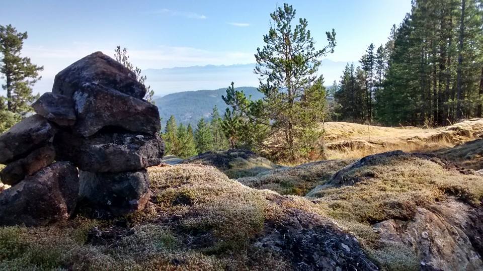 Cairns that the top |
South side of the summit (descent route)
Mount McDonald
Mount McDonald is another mountain in the Sooke Hills that has a great view of the Westshore and downtown Victoria.
Getting there:
You can apparently get to Mount McDonald from the parking spot for Sugarloaf and Braden; however, Darryl and I approached it from Humpback Rd. Basically you drive past the parking lot on Humpback Rd for Mount Wells. The trail head for Mcdonald is just after the narrow part of the road where you have to honk your horn. There is a small pull off on the west side of the road that can fit 1 or 2 cars. Park here and walk ahead to a row of 10 or so large rocks and a white CRD sign. The trail starts behind these rocks.
The trail up to the summit is quite pretty. It emerges out of the forest onto bluffs covered in grass and big arbutus trees. It is fairly steep and people have left a couple ropes on one of the more difficult sections. The ropes are not necessary, but are nice for comfort.
It took Darryl and I just over 30mins to reach the summit, which is just higher than Mount Wells. The trail is exactly 1km long from Humpback Rd to the summit. Some people walk down the back side of the mountain on the descent via a road. We decided to just stick on the same trail we used to climb up.
 | 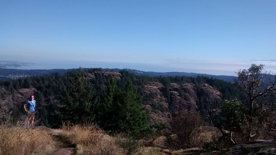 view of Mount Wells 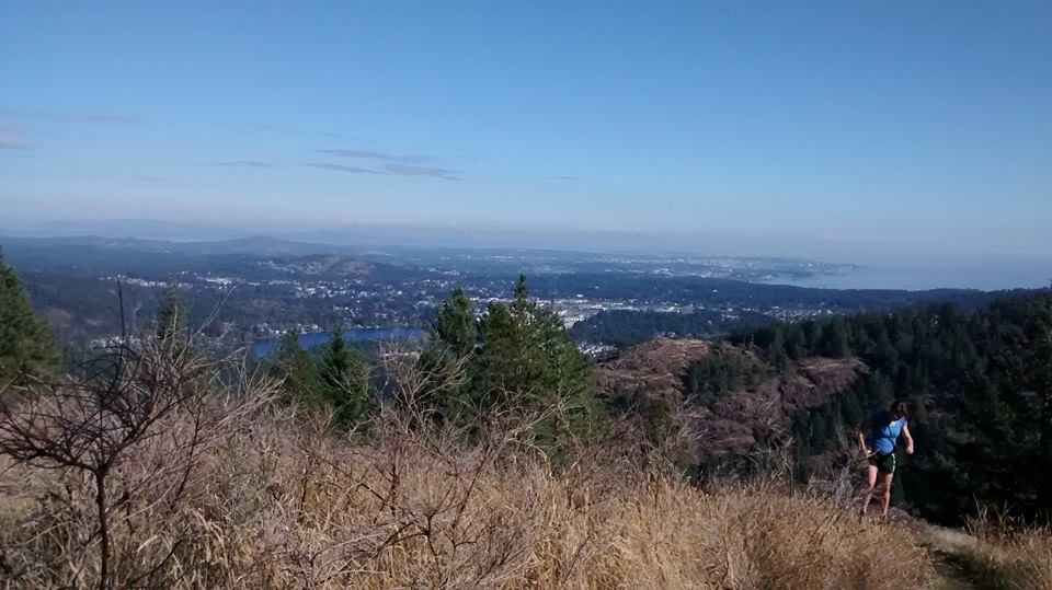 View of the Westshore and Victoria 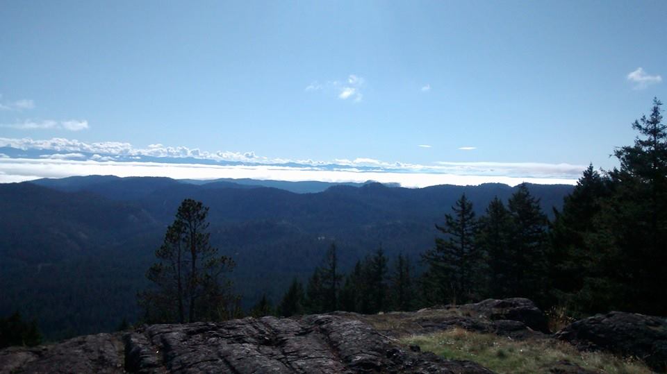 |
 |  Surveyors Marker |
 RSS Feed
