We set off hiking at around 1340 on a crisp fall day. There were some clouds in the sky, but a bit of blue poking through. The trail started off crossing a creek and then following an old road for a short period. Eventually the trail became single track and followed the left side of a creek up to the base of some shaley mountains. Here the trail was fairly booted and well flagged. We clambered over a few newer mud slides that would have probably been alarming if one was around when they came down. |
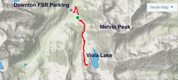
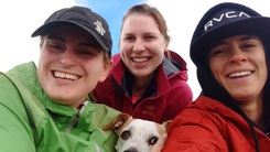
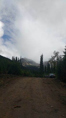
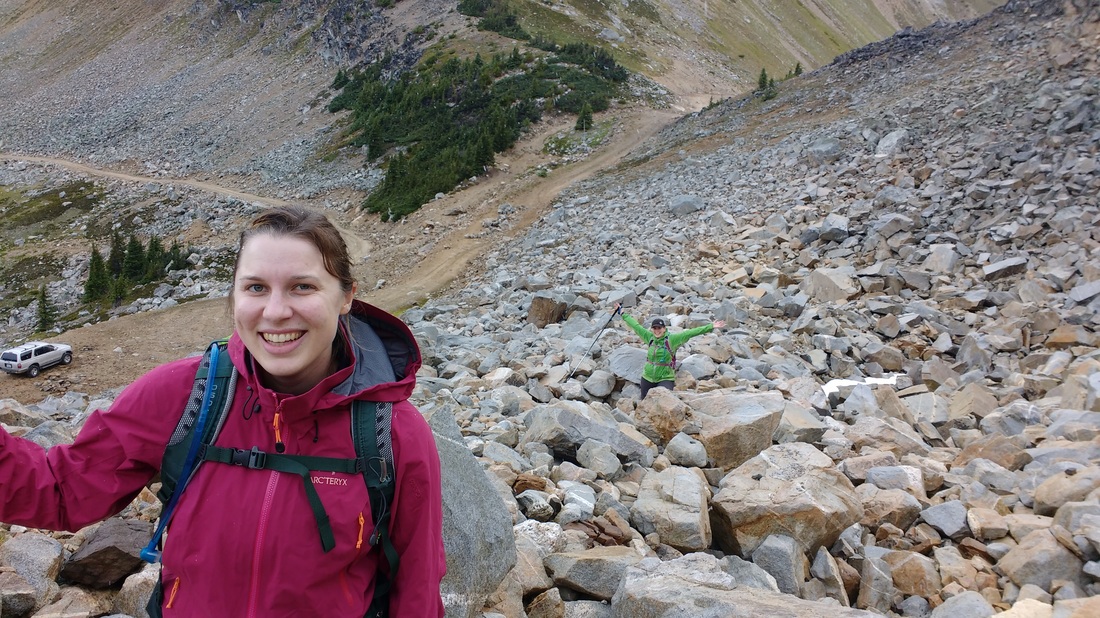
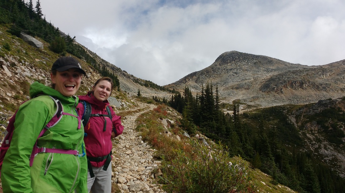
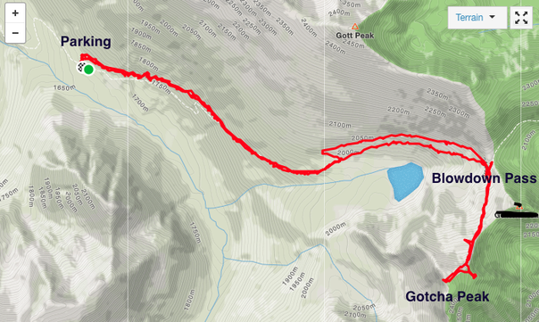
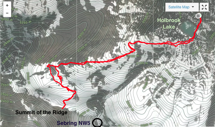
I have heard from many Lillooet locals about how beautiful and accessible the lakes, trails, and mountains of Downton FSR are. Last weekend Darryl, some Lillooet pals Jen and Mike, and I set off for Viola Lake as an easy day hike. This is a fairly simple hike off of a branch of Downton FSR that climbs through a valley along a creek about 560m in elevation and 3.5kms (one way) distance to a beautiful alpine lake. We left Lillooet at a leisurely time of around 1130. We followed the instructions in the Canyon to Alpine guide, which told us to drive 24 kms south on the Duffey Lake Rd from downtown Lillooet and turn right on Downton FSR. We then followed this fairly decent gravel road for around 11kms and then kept left (there are more hikes on the right fork as well). We parked 3.5kms down from this fork in the road at a yellow sign pointing towards Viola Lake.
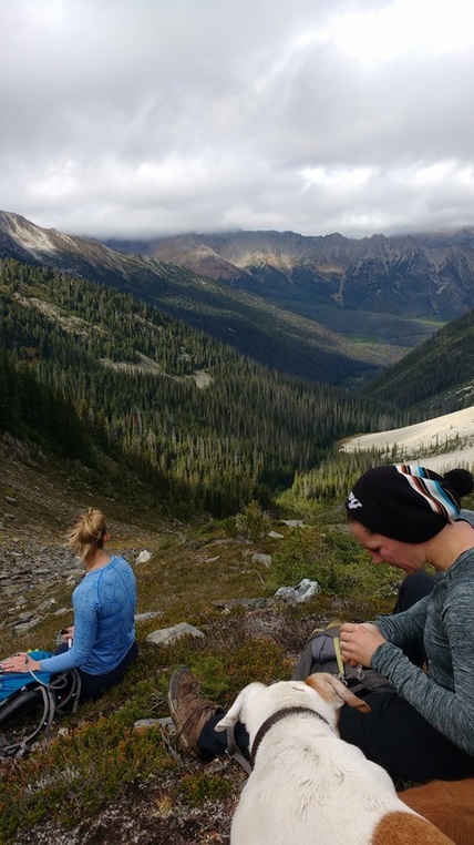
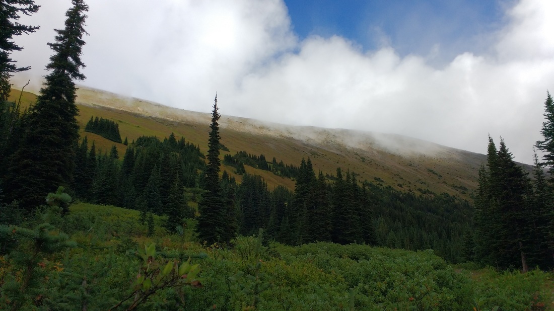
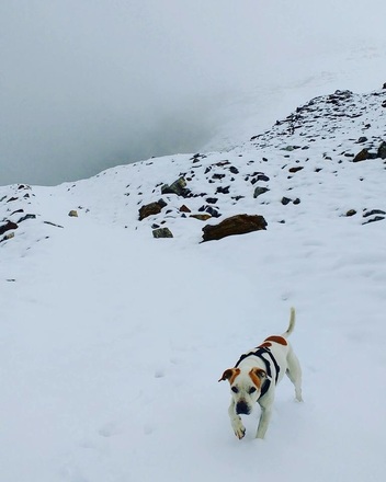
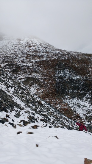
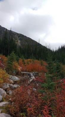
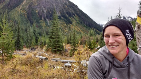
 
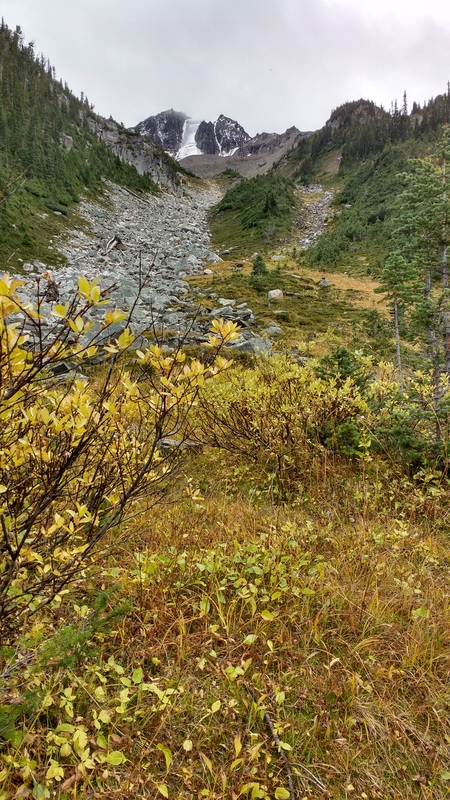
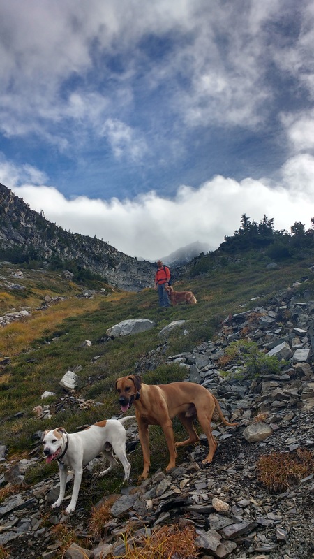
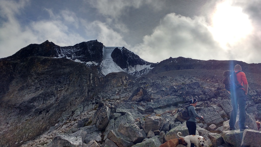
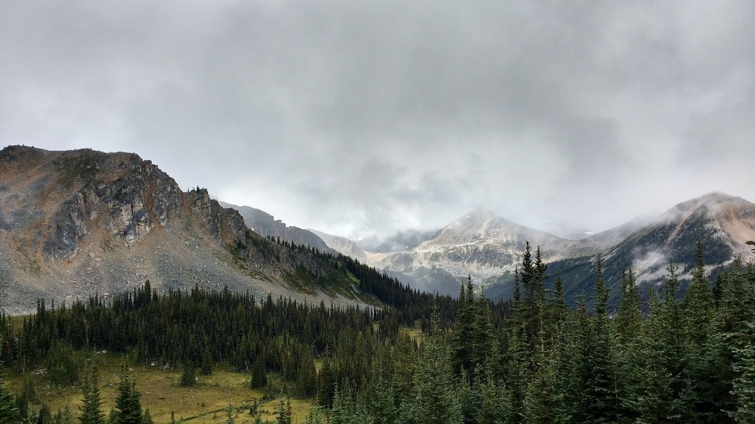
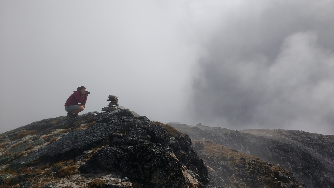
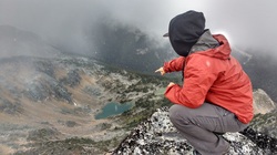
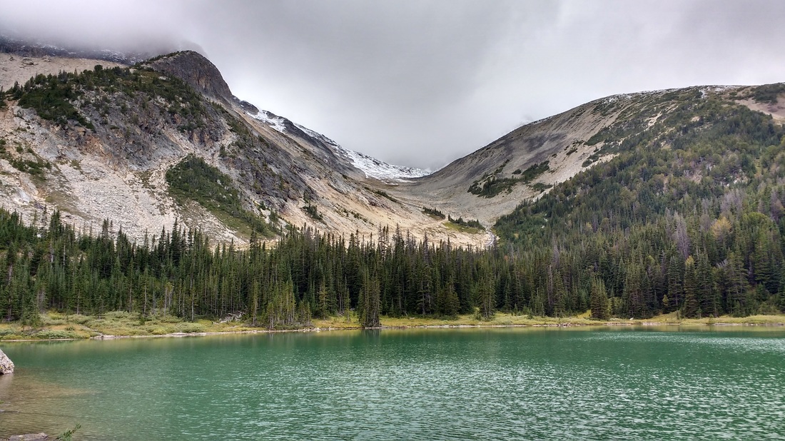
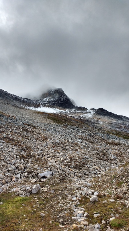
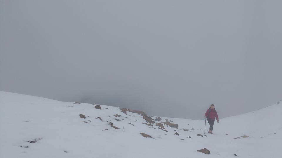
The hike up the valley was stunning. The leaves had begun to change colour brightening up the landscape. We approached a very neat jagged peak with a unique looking glacier. At first it just looked like weirdly accumulated snow, but when we arrived at the viewpoint for the lake we saw huge boulders crash and bounce off of the solid ice of the glacier. The route we took perched us quite high above the lake, which was a deep blue/green in colour. Above the west side of the lake there is a shaley ridge that leads to Melvin Peak. This looks like a fairly straightforward ridge walk we could do in a future trip.
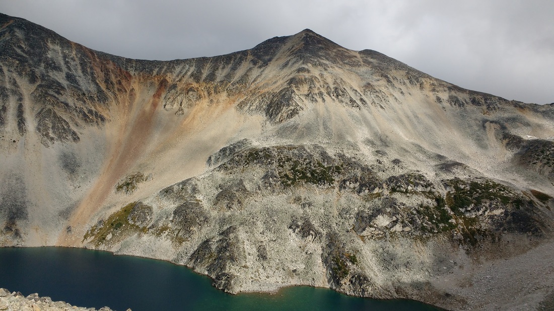
 
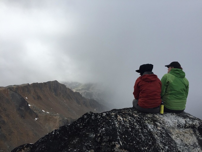
We sat and ate lunch taking the in the view for some time, but eventually made our way back down. The trip down was much faster than the trip up and we arrived back at the truck in one piece around 1700.
0 Comments
Blowdown Pass, Gotcha Peak I have been anticipating an adventure-filled visit from my Victoria ER nurse pals Lauren and Corinne ever since we moved to Lillooet. To my luck these two decided to make me a stop on their summer road trip around BC. Therefore, I couldn't disappoint! I planned two solid day hikes in the Lillooet area to give them a taste of the wild in my new home. The first hike we did was up Gotcha Peak in the Blowdown Pass area just off of the Duffey. For more instructions on location refer to my trip report on Gott Peak. Gotcha Peak is a slightly shorter,
We stopped a few time to snap pictures and wait for Corinne, but eventually made it to the pass at 1150 and had a snack. Here there was a Toyota 4Runner parked on the last switchback before the top of the pass. I was impressed, that road is rough! It was hard to see where the trail carried on to Gotcha, but we made our way straight up through the boulders and eventually started to notice the odd cairn. This route is not booted and requires you to have an idea of where you are headed. The walk up the summit block was a bit tedious over boulders, but not too bad. My biggest complaint was that the clouds rolled into us as we climbed and it started to snow sideways. I was quite shocked, it was cold, but I didn't think it was that cold! We all kind of laughed and carried on up the slope. About 200m from the summit we had to do about 10m of clambering up on hands and feet, but nothing alarming. We arrived at the summit at 1240. By the time we reached the top the snow had subsided and the clouds lifted just enough to give us some beautiful views of the lakes below us to the southwest. There is a trail that climbs from Blowdown Lake to this area and it would be a great place to camp. Most of the surrounding mountains were under cloud cover, but the views were dramatic nonetheless. We had a break, snapped some photos, and had a snack. However, we didn't linger long because the snow started to fly again and it was chilly. We were a bit zealous headed in the wrong direction on the way down, but corrected ourselves quickly. We made it back to the truck mainly without incident by 1500. Holbrook Creek The following day Lauren and I left Corinne behind for a relaxing day and headed for Holbrook Creek out towards Gold Bridge. We reset the odometer at the Mile 0 cairn in Lillooet and took Hwy 40 towards Gold Bridge. 34 kms down the road we took a right hand turn onto Larochelle FSR and climbed our way up the winding road. We followed the directions in the Canyon to Alpine book, staying on the main road and avoiding less travelled offshoot roads. At 55 kms we took a left down onto a rugged 4x4 road for the last 2kms. It was very steep, windy, and rough. My heart was beating fast a number of times, however one could always walk this part. We arrived at Holbrook Lake, which is absolutely breathtaking and crystal blue/green, at 1215 and parked along the right side of the lake. The road we had driven up on carried on to the left of the lake. It is an old mining road and is now a very rough 4x4 road into the alpine. I should mention that motorized vehicles are to stay on pre-existing roads above 1700m and are not allowed to "off-road," which disturbs the fragile alpine environment and takes hundreds of years to heal. We walked this mining road and stuck left at the fork above the lake. We could see that we were headed for snow and fog, but carried on anyways. At about 2200m we hit snow. Very minimal at first, but got deeper and deeper as we climbed. We saw a couple ptarmigans walking around, but quickly lost them as they camouflage well into the rock and snow. We could also hear the odd marmot call and pika chirp, but never saw them. We were headed for the peak of Sebring NW5 as according to google maps, which should be a nice easy walk up from the ridge. However, as we carried on the snow started to accumulate making travel in trail runners seem pretty pathetic. If we had known there was going to be snow we could have worn thicker socks, mountaineering boots, and gators. We arrived at the big rock slide over the road and decided to cut left to head up to the ridge. This was very tricky as most of the rocks were unstable and covered in snow. Here the dog cut his foot and was bleeding with every step. I examined the cut and saw that it was only a scrape and he wasn't in any distress or limping so we carried on. By the time we cut back up onto the road heading for the ridge we were immersed by cloud. It looked as though we were on an adventure of epic proportions and headed to the gates of Mordor. We plodded our way up and up until eventually we were on top of the ridge about 50m below the summit of Sebring NW5. The wind was howling, the snow was deep, visibility was poor, and it was cold as heck. We made an executive decision to head back home before anything silly happened.
The hike back down was without incident, but it did start to rain quite good when we were just below the snow level. We hustled our way back to the truck and cranked the heat. I must return and camp on the beautiful lake and retry this peak! |
Author: Tiffany CI am a registered nurse currently living in Lillooet, BC, but originally from Gold River, BC on Vancouver Island. I enjoy hiking, biking, kayaking, walking, running, surfing, climbing and racing! Categories |