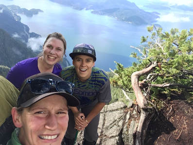
Summer 2017 has been a good one, but is now coming to an end. To conclude the season Lauren, Darryl and I decided to tackle the Howe Sound Crest Trail. We had longstanding plans to undergo this hike in mid-September when our shift work schedules magically aligned. Hiking in September always seems like a great idea earlier in the summer when one can't imagine the weather turning sour... I may rethink this in future.
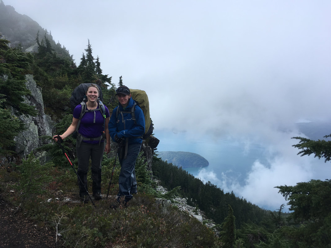
The Howe Sound Crest Trail runs over and around the mountains that loom over the Howe Sound, far above the Sea to Sky highway. It crawls over St Marks Summit, Mount Unnecessary, and James Peak. One could also scramble the Lions or hike up Brunswick Mountain as a relatively short side trip from the trail. The trail (in good weather) offers stunning views of the ocean, Sea to Sky highway, and Sunshine Coast. We planned on powering out this 30k hike in one night, which seemed like the norm from what I had read online. While we accomplished this hike as planned, in one night, it was much more difficult than I anticipated and the first day required hours longer than we imagined.
The Howe Sound Crest Trail runs over and around the mountains that loom over the Howe Sound, far above the Sea to Sky highway. It crawls over St Marks Summit, Mount Unnecessary, and James Peak. One could also scramble the Lions or hike up Brunswick Mountain as a relatively short side trip from the trail. The trail (in good weather) offers stunning views of the ocean, Sea to Sky highway, and Sunshine Coast. We planned on powering out this 30k hike in one night, which seemed like the norm from what I had read online. While we accomplished this hike as planned, in one night, it was much more difficult than I anticipated and the first day required hours longer than we imagined.
Day 1
The first day was a bit of a mess around taking the first ferry from Nanaimo to meet Darryl who had slept in the truck in Squamish for some crazy reason... We then had to organize all three of our vehicles, dropping one in Squamish, leaving one in Porteau Cove, and taking one to Cypress Mountain to start the hike. All the ferry riding, driving, and car dropping meant that we did not start out on the trail until late morning. I figured this was fine, anticipating that our 14.5km day would take us around 6hrs. I knew that there was a considerable amount of elevation gain and loss, but we were experienced hikers and used to a good slog.
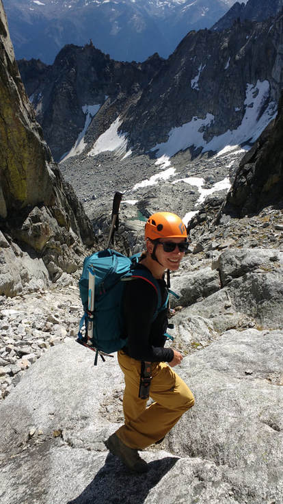
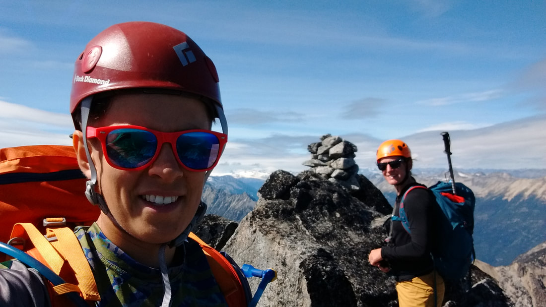
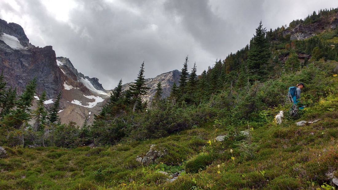
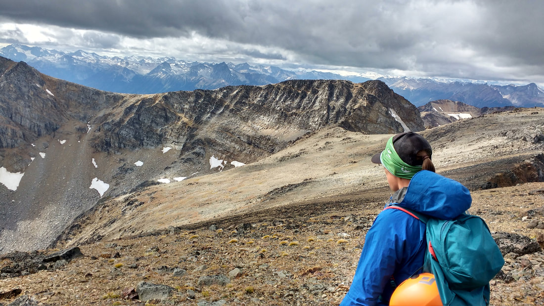
The weather forecast was quite threatening, calling for rain and cool temperatures, but we were prepared. We had rain gear and tarps for the tent. The skies were cloudy with the odd glint of sun shining through now and again. We set off from the Cypress parking lot at 915m of elevation into the brisk morning at 1020. The start of the trail was wide with a steady trend uphill. Many switchbacks took us up and up to St Marks Summit. While it was cloudy we still were treated to beautiful views of the Howe Sound and Sea to Sky corridor below.
The weather forecast was quite threatening, calling for rain and cool temperatures, but we were prepared. We had rain gear and tarps for the tent. The skies were cloudy with the odd glint of sun shining through now and again. We set off from the Cypress parking lot at 915m of elevation into the brisk morning at 1020. The start of the trail was wide with a steady trend uphill. Many switchbacks took us up and up to St Marks Summit. While it was cloudy we still were treated to beautiful views of the Howe Sound and Sea to Sky corridor below.
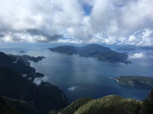
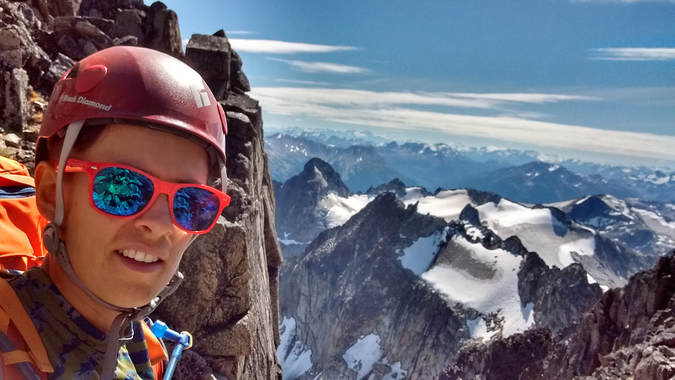
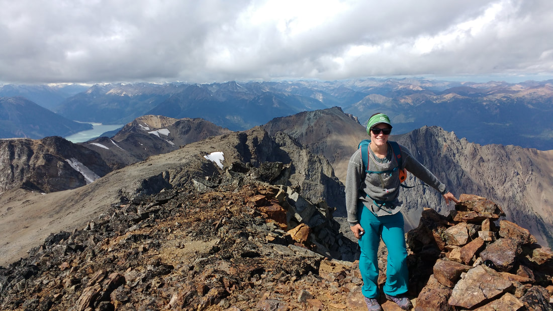
Bowen Island and the Seas to Sky Hwy from St Marks
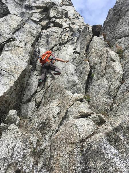
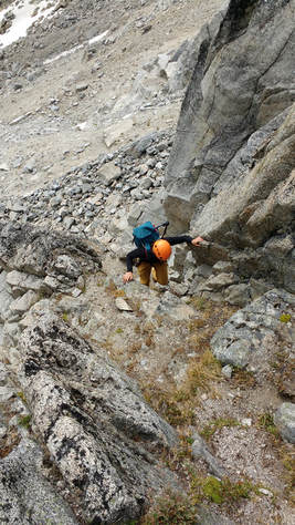
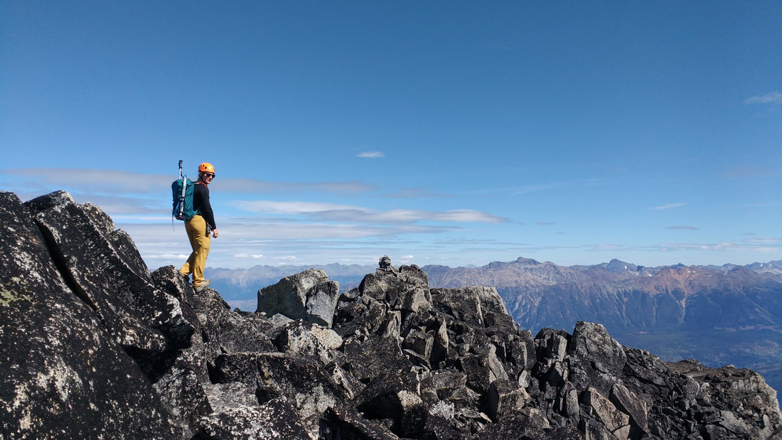
We lingered for a short while and had a small snack before carrying on down the trail towards Mount Unnecessary. From this point the trail became much more technical and steep. Slight route finding was necessary due to many trails shooting off here and there. We had to make an effort to follow the trail markers in the trees rather than trusting what we saw on the ground. There were many roots, rocks, and logs to navigate, but we made good progress and popped up onto Mount Unnecessary South Peak in no time.
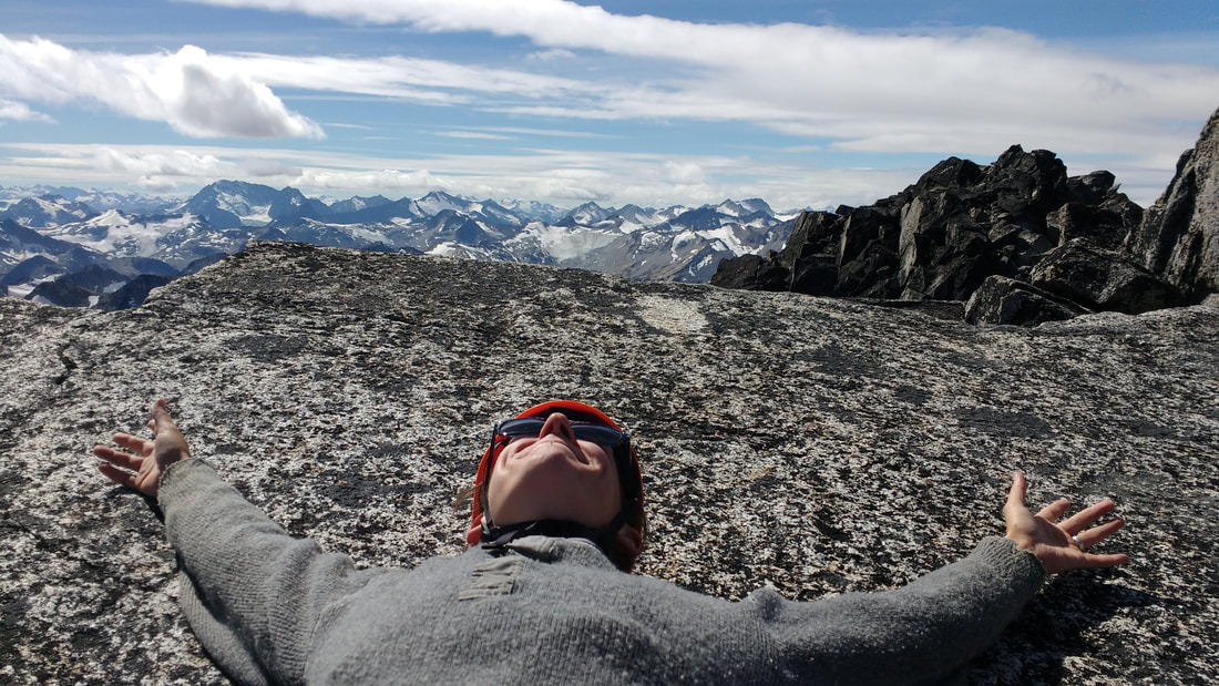
At this point I was feeling pretty good. We were at the highest point of the trail and making good progress. I knew we still had some distance to cover, but the weather was holding out and life was good. We carried on to the North Summit and headed down again. There were a few technical spots and the odd rope to utilize here and there.
Now here is where the day took a bit of a turn... The fog rolled in obstructing all views and the temperature started to dip. We knew that we were headed for the Lions and upset that we would not be able to see them. We marched on and on until suddenly Lauren exclaimed that the large dark mass looming above us must be a Lion. We all concurred. Just as this happened it started to hail. At first we were thankful that it was not raining, until the hail turned to snow! It was a blizzard! I was quite shocked. I knew we were in the alpine, but we were also right on the coast!
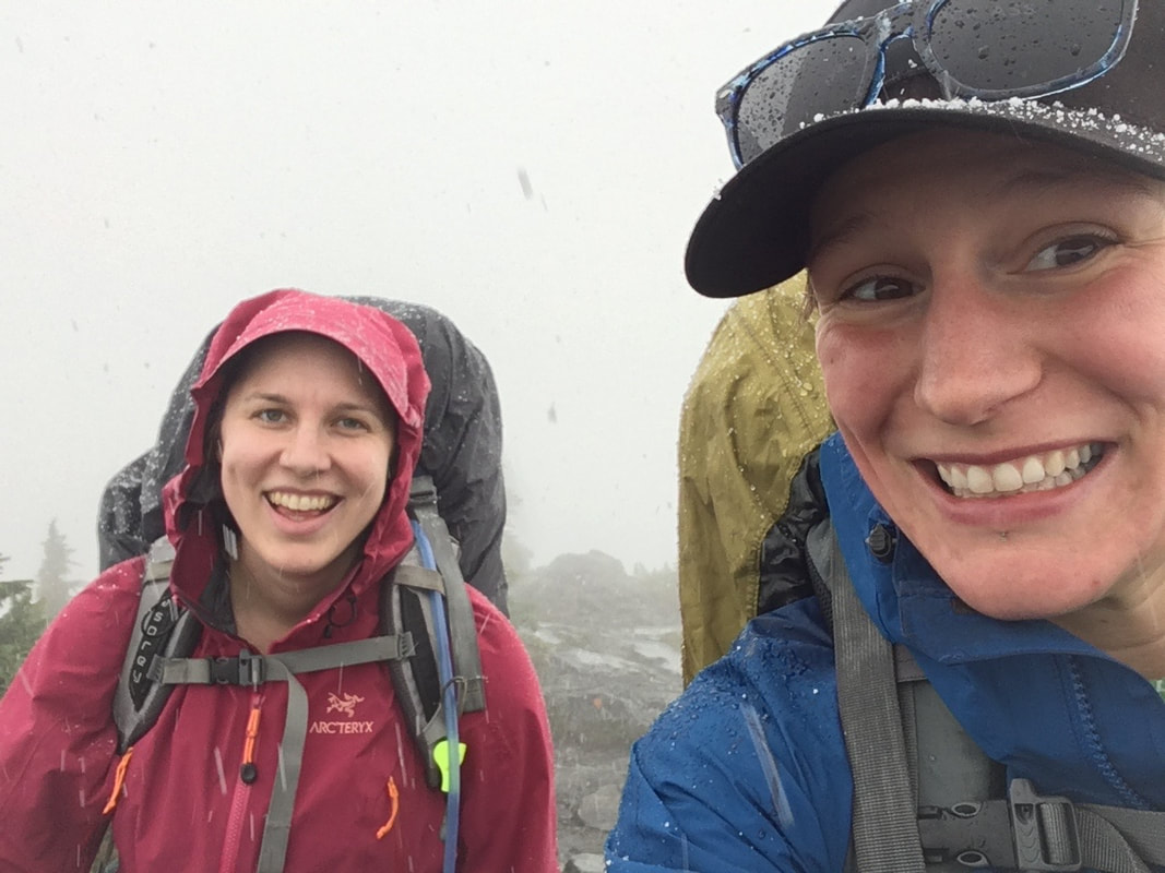
Snowing!
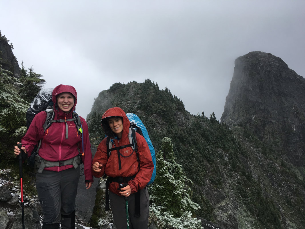
Between the Lions- Lauren is too happy
The snow didn't accumulate on the ground, but made things a bit more slippery and slowed our pace considerably. We passed through the Lions, which was quite technical and rocky ending with us clambering through damp bush. Here my pants were quite wet and I figured it was too late for rain pants. We just trudged on hoping that we would reach our destination of Magnesia Meadows in short order. Goodness were we wrong...
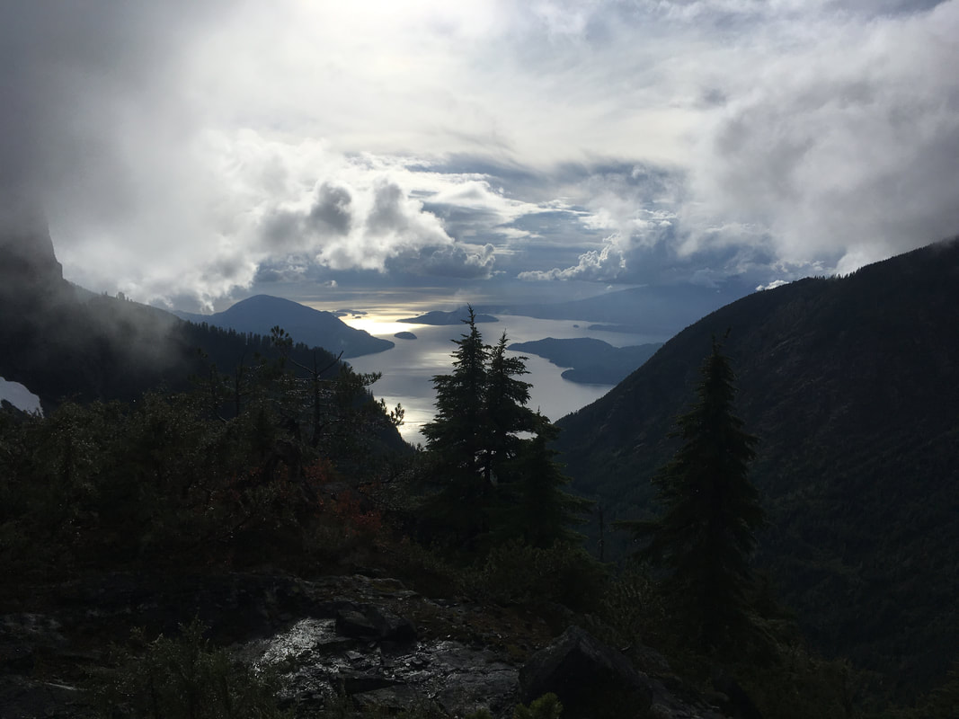
The next section of trail was very tricky. The snow ceased, but everything was damp and the skies were grey. We climbed up and down, the trail always sticking to the highest and most technical grounds. At many points we were literally climbing hands over feet. It was extremely slow going and it was getting late in the day. At what should have been supper time we arrived at another high point in the land. The fog had lifted slightly and we could again see the ocean. I was extremely hangry and had not eaten in quite some time. My water was also gone and I did not care to stop and make more. I just wanted the day to be over! I quickly ate a protein bar and stole some water from Darryl. We came up with the saying 'it's hard to have vigor when you haven't had dinner.'
We considered our grim situation and knew that there would not be daylight much longer. Why was this taking so long?? Was the GPS wrong?? Did we overshoot the meadow? I knew it wasn't possible. This trail was simply ridiculous!! We again carried on down. The trail was extremely steep and slippery, which was ever so difficult on tired legs. The dog was whimpering every time my pace slowed so I took off his pack to make things a bit easier for him.
We reached a low point in the ridge and considered camping, but realized there was no water source. Thus, we pushed up and up again. The trail here seemed to mellow out. There was less climbing and more hiking involved. We were again making good time. Just then I spotted a black furry object below the trail, which turned its head and looked at me! It was a bear! I immediately made myself known by yelling "HEEEEEY BEEEAR!!" and the girls shortly followed suite. The bear contemplated the threat for some time before deciding to make a run for it. Things were seeming pretty sketchy at this moment in time, knowing that we might be camping close to our new furry friend.
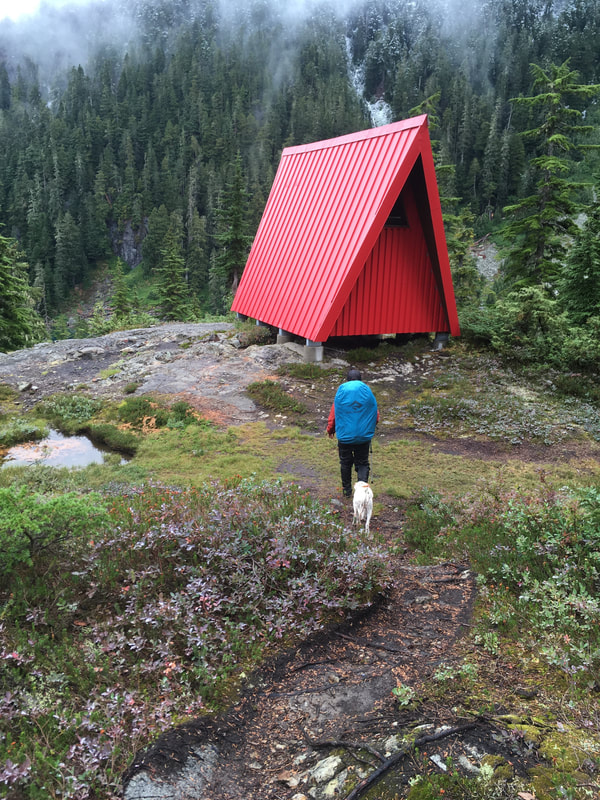
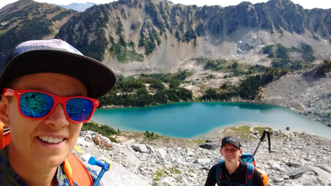
Once we reached the top of the climb I took an estimate on the GPS, which showed that the meadows and an emergency (and bear free) shelter was only 450m away! This put some serious pep in our step and we hustled. Finally we came upon a good tarn for water and shortly after a tiny red emergency shelter we all agreed to call home for the night. We peered inside the cabin and saw that it was quite small with no frills of any sort, but we knew we would fit and it was dry. We had travelled 17kms according to my GPS, when we thought we would only be doing 14.5kms. I assume that the hike from the Cypress parking lot to the actual trailhead must be where the discrepancy lies. It was 1840 in the evening and near dark.
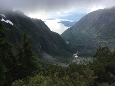
The rest of the evening was a blur. I remember stripping off my wet clothes and putting on dry sleeping attire. Heavenly! We squished into the loft of the cabin and lay about on our sleeping bags and mattresses eating warm Mr Noodles and any other tasty food we could find in our bags. It was pure bliss compared to our soaking wet, cold, never-ending hike. When I went out to pee before bed I could see the ocean down below us and glinting lights from the Sunshine Coast. It was beautiful, and also daunting knowing how high above civilization we were. Tomorrow was going to be a rough day. That night I didn't sleep as poorly as I usually do on adventures, but poor nonetheless.
The next section of trail was very tricky. The snow ceased, but everything was damp and the skies were grey. We climbed up and down, the trail always sticking to the highest and most technical grounds. At many points we were literally climbing hands over feet. It was extremely slow going and it was getting late in the day. At what should have been supper time we arrived at another high point in the land. The fog had lifted slightly and we could again see the ocean. I was extremely hangry and had not eaten in quite some time. My water was also gone and I did not care to stop and make more. I just wanted the day to be over! I quickly ate a protein bar and stole some water from Darryl. We came up with the saying 'it's hard to have vigor when you haven't had dinner.'
We considered our grim situation and knew that there would not be daylight much longer. Why was this taking so long?? Was the GPS wrong?? Did we overshoot the meadow? I knew it wasn't possible. This trail was simply ridiculous!! We again carried on down. The trail was extremely steep and slippery, which was ever so difficult on tired legs. The dog was whimpering every time my pace slowed so I took off his pack to make things a bit easier for him.
We reached a low point in the ridge and considered camping, but realized there was no water source. Thus, we pushed up and up again. The trail here seemed to mellow out. There was less climbing and more hiking involved. We were again making good time. Just then I spotted a black furry object below the trail, which turned its head and looked at me! It was a bear! I immediately made myself known by yelling "HEEEEEY BEEEAR!!" and the girls shortly followed suite. The bear contemplated the threat for some time before deciding to make a run for it. Things were seeming pretty sketchy at this moment in time, knowing that we might be camping close to our new furry friend.
Once we reached the top of the climb I took an estimate on the GPS, which showed that the meadows and an emergency (and bear free) shelter was only 450m away! This put some serious pep in our step and we hustled. Finally we came upon a good tarn for water and shortly after a tiny red emergency shelter we all agreed to call home for the night. We peered inside the cabin and saw that it was quite small with no frills of any sort, but we knew we would fit and it was dry. We had travelled 17kms according to my GPS, when we thought we would only be doing 14.5kms. I assume that the hike from the Cypress parking lot to the actual trailhead must be where the discrepancy lies. It was 1840 in the evening and near dark.
The rest of the evening was a blur. I remember stripping off my wet clothes and putting on dry sleeping attire. Heavenly! We squished into the loft of the cabin and lay about on our sleeping bags and mattresses eating warm Mr Noodles and any other tasty food we could find in our bags. It was pure bliss compared to our soaking wet, cold, never-ending hike. When I went out to pee before bed I could see the ocean down below us and glinting lights from the Sunshine Coast. It was beautiful, and also daunting knowing how high above civilization we were. Tomorrow was going to be a rough day. That night I didn't sleep as poorly as I usually do on adventures, but poor nonetheless.
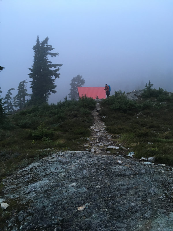
Magnesia Meadows Shelter
Day 2
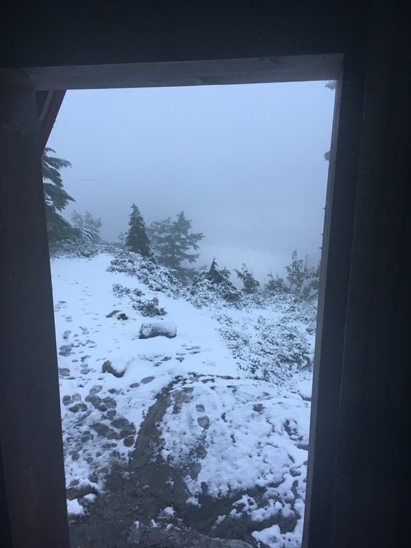
0600. Beep, beep, beep goes the alarm. Out we crawl from our sleeping bags and Lauren exclaims "Oh no!" and points out the window. The ground is blanketed in fresh snow. This hike out was going to be a real doozy. We knew that we had an even longer day then the one previous and had no idea what to expect. However, the motivation to get back to Squamish was in full effect and I could almost taste the victory beer and pizza at Backcountry Brewing.
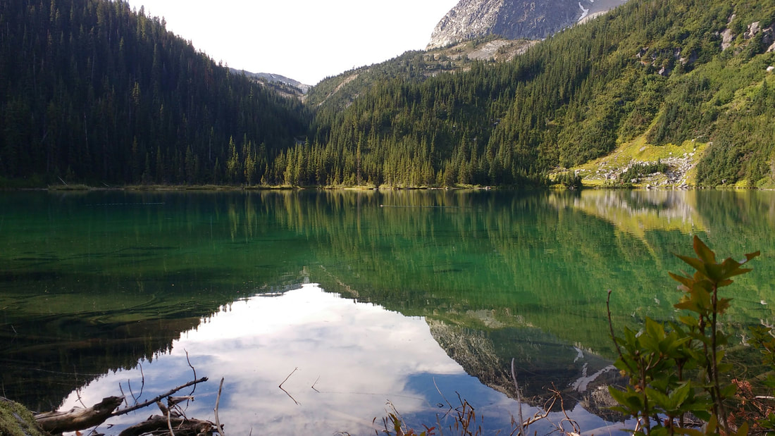
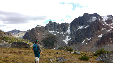
Putting on damp cold clothes was not awesome. We all agreed however that it was great not to have to pack up a wet tent. We set off on the trail at 0740 and set our sights on Porteau Cove. The start of the walk was a bit treacherous. There was just enough snow to freeze my toes and cause me to slip and slide all over the place. However, the grade of the hike was easy and we made good time. In no time at all we arrived at the Brunswick Lake shelter and had a small snack. We took in the beauty of the surrounding area blanketed in snow. Brunswick Lake was a beautiful blue green down below us. It was stunning.
Putting on damp cold clothes was not awesome. We all agreed however that it was great not to have to pack up a wet tent. We set off on the trail at 0740 and set our sights on Porteau Cove. The start of the walk was a bit treacherous. There was just enough snow to freeze my toes and cause me to slip and slide all over the place. However, the grade of the hike was easy and we made good time. In no time at all we arrived at the Brunswick Lake shelter and had a small snack. We took in the beauty of the surrounding area blanketed in snow. Brunswick Lake was a beautiful blue green down below us. It was stunning.
 Morning views... | 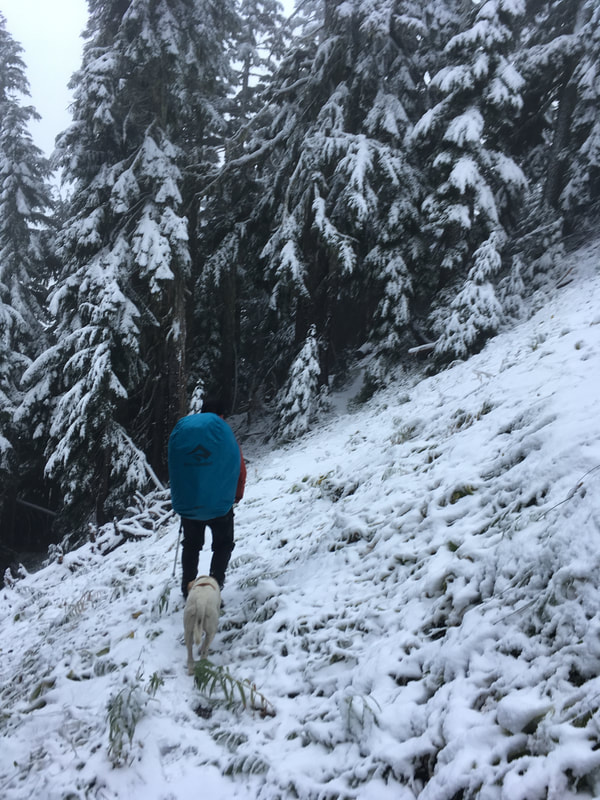 |
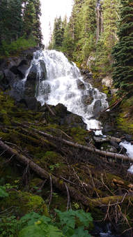
The going from here down to Hanover and Deeks Lake was a bit tedious, but not nearly as bad as the day previous. There were a number of waterfalls off to the side and the trail was heading downward, which was comforting. We passed the time yelling out random things and singing various songs. In no time we were passed Deeks lake and the trail widened into what I think is an old road for the majority. We had another quick snack and I noticed that my water leaked into my hiking bag... I was having no luck with water.... So Lauren graciously shared with me and I purified some more along the way.
Eventually we hit the road! What a relief. Signs began to count down to Porteau Cove and our paced quickened with the easier terrain. We sang more songs and chit chatted, and just like that we were at the car. I was so happy I could have kissed it! It was 1330. We tapped hiking poles together in celebration and loaded our wet gear into the car. My GPS stated that we covered another 16k, making 34kms total from where we parked. 1800ish metres of cumulative elevation gain. Needless to say I will never do this trail again. Maybe a day trip to the Lions? Until the next adventure, cheers!
Eventually we hit the road! What a relief. Signs began to count down to Porteau Cove and our paced quickened with the easier terrain. We sang more songs and chit chatted, and just like that we were at the car. I was so happy I could have kissed it! It was 1330. We tapped hiking poles together in celebration and loaded our wet gear into the car. My GPS stated that we covered another 16k, making 34kms total from where we parked. 1800ish metres of cumulative elevation gain. Needless to say I will never do this trail again. Maybe a day trip to the Lions? Until the next adventure, cheers!
Brunswick Lake Cabin
 RSS Feed
