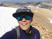
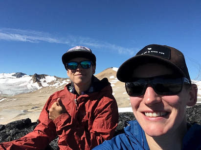
Last year I was doing my typical surf of Google Earth and happened upon some breathtaking photos in an area called Athelney Pass. It is located northwest of Pemberton and south of Gold Bridge. Access looked tricky, but there was some information on the internet about people hiking their way in. It looked like a great and rewarding challenge so I made plans to go in there for my 31st birthday with Darryl.
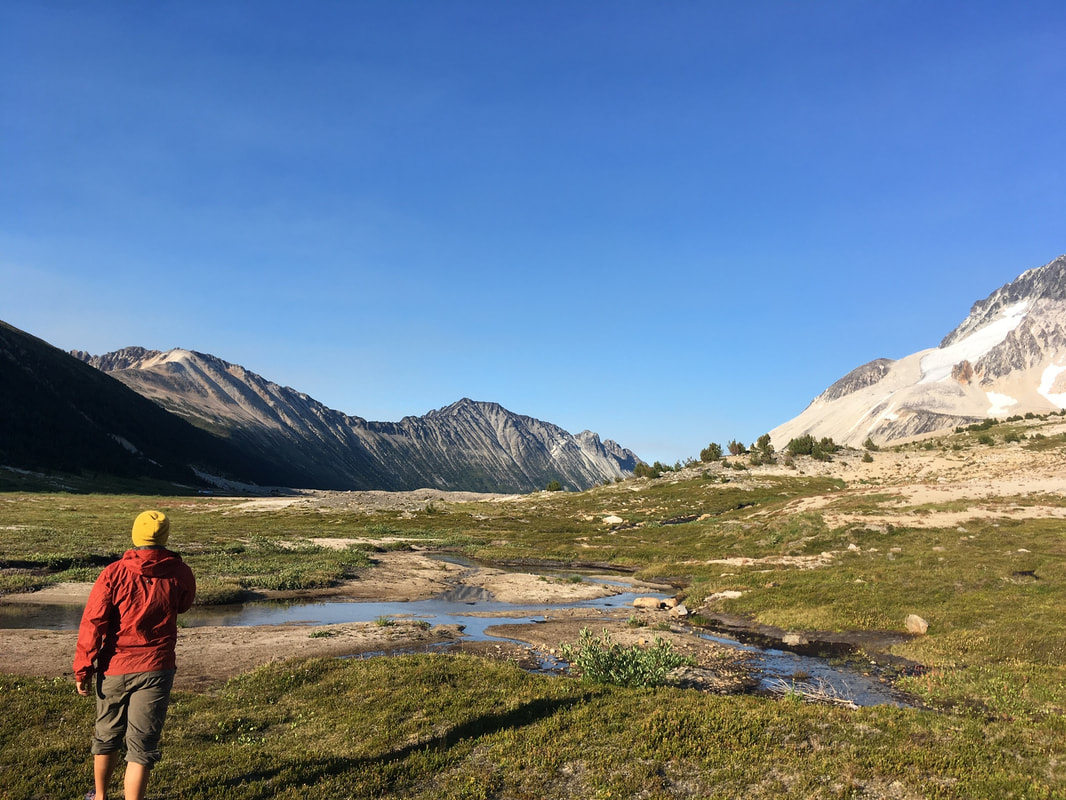
The best access to the pass is from Pemberton, up Lillooet River FSR, up by a mine on an old logging spur. From what I had heard the hiking route was going to be a long 15k slog up Salal Creek, hopping on boulders and thrashing through bush. We planned to give ourselves around eight hours to get to the pass and set up camp. We left Lillooet on a scorcher day in August at around 0600, stopped at Mount Currie Coffee Co, and arrived at the trailhead at 1000.
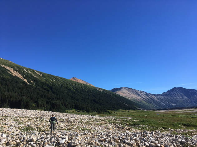
We set off at the end of a logging road and headed into the bush. From what I had read the goal was to get down to the river and then start making our way up it. There was a slight trail and some flagging to start that lined up with a GPS track given to me by a Pemberton local. Almost immediately we lost the flagging, which I wasn't entirely shocked about, thinking that this place was rarely visited. I was definitely wrong... Turns out there is a flagged route almost all the way to the pass. We made the mistake of losing it almost immediately, which cost us hours and added distance on the way in.
At first, when we headed down to Salal Creek the river bank was high with no sign of a beach below. We followed along the river for some distance until we could see rocks below to walk on. We walked on the beach for a short while before the alders and brush choked up along the river bank and we were forced into the forest again. Luckily we noticed some flagging and a well booted route. I was shocked at how well booted this spot was and how poorly the start of the trail had been. This should have been an indication that we should be following the flags and GPS more closely...
The best access to the pass is from Pemberton, up Lillooet River FSR, up by a mine on an old logging spur. From what I had heard the hiking route was going to be a long 15k slog up Salal Creek, hopping on boulders and thrashing through bush. We planned to give ourselves around eight hours to get to the pass and set up camp. We left Lillooet on a scorcher day in August at around 0600, stopped at Mount Currie Coffee Co, and arrived at the trailhead at 1000.
We set off at the end of a logging road and headed into the bush. From what I had read the goal was to get down to the river and then start making our way up it. There was a slight trail and some flagging to start that lined up with a GPS track given to me by a Pemberton local. Almost immediately we lost the flagging, which I wasn't entirely shocked about, thinking that this place was rarely visited. I was definitely wrong... Turns out there is a flagged route almost all the way to the pass. We made the mistake of losing it almost immediately, which cost us hours and added distance on the way in.
At first, when we headed down to Salal Creek the river bank was high with no sign of a beach below. We followed along the river for some distance until we could see rocks below to walk on. We walked on the beach for a short while before the alders and brush choked up along the river bank and we were forced into the forest again. Luckily we noticed some flagging and a well booted route. I was shocked at how well booted this spot was and how poorly the start of the trail had been. This should have been an indication that we should be following the flags and GPS more closely...
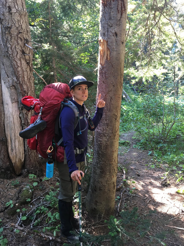
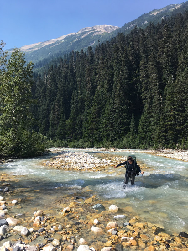 One of the first cute river crossings | 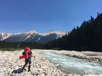 |
The forest walk was short and again we were out on the beach. There were many annoying rocks walk on, and a few river branches to wade through, but nothing major. However, after a few kilometres the river on the east bank again became choked in alder and bush. We looked for a path into the woods and did not see one so we made the plan to cross the river and carry up the beach on the other side that seemed to go much further (big mistake).
The river crossing was a bit hairy, but not too bad. With slow movements and careful footing we both made it across and were only wet up to our knees. We walked for around another kilometre and found the beach again choked in by forest, this time on both sides of the river. I eyed the GPS, which showed the track on the other side of the river... However, now it was too deep to walk across... We made the decision to bushwhack on the west side of the river and look for another spot to cross farther up.
The going started off easy. An old growth forest with mossy ground and spread out trees. We made note that we were starting to climb high above the river, as the river bank turned into cliffs. I was relived when we started to head back down closer to the river again, but not for long. We walked into an old avalanche slide path full of thick alder and old log debris. It was horrendous. We could not see anything around us, including the ground. We decided to immediately head for the river and look for a place to cross.
When we arrived at the river we were literally hanging off of alder branches that grew right over the bank. Salal Creek was raging and it was far too unsafe to cross. I was stumped... I looked at Darryl for suggestions. We knew our only hope was to keep bushwhacking upwards and look for a safer place to cross. Going back would waste too much time. Thus, we headed back into the alder. It was NASTY. Trees so thick I could not see through and logs piled high on the ground. Getting through with my multi-day pack on was a struggle. At one point I fell down into what looked to be a swap and considered laying down to cry for a while. We were seemingly getting nowhere on an already long day.
When I snapped out of my sad state, I got up and pulled myself together. I looked around and saw light, knowing it would be the river bank. I called Darryl and made a dash for the opening. It was indeed a beach and the river still looked frightening, but not quite as bad as before. Once Darryl met up with me we both pondered where to cross. She was not feeling good about it, but we could see the the forest again choked in the beach a short distance up river. Therefore we picked a spot and went slowly one at a time. It was scary as heck and we were both soaked nearly up to the waste in raging water, but we made it. Once on the other side we sat down for our first break of the day and had lunch. We were 9kms in and it was around 1300.
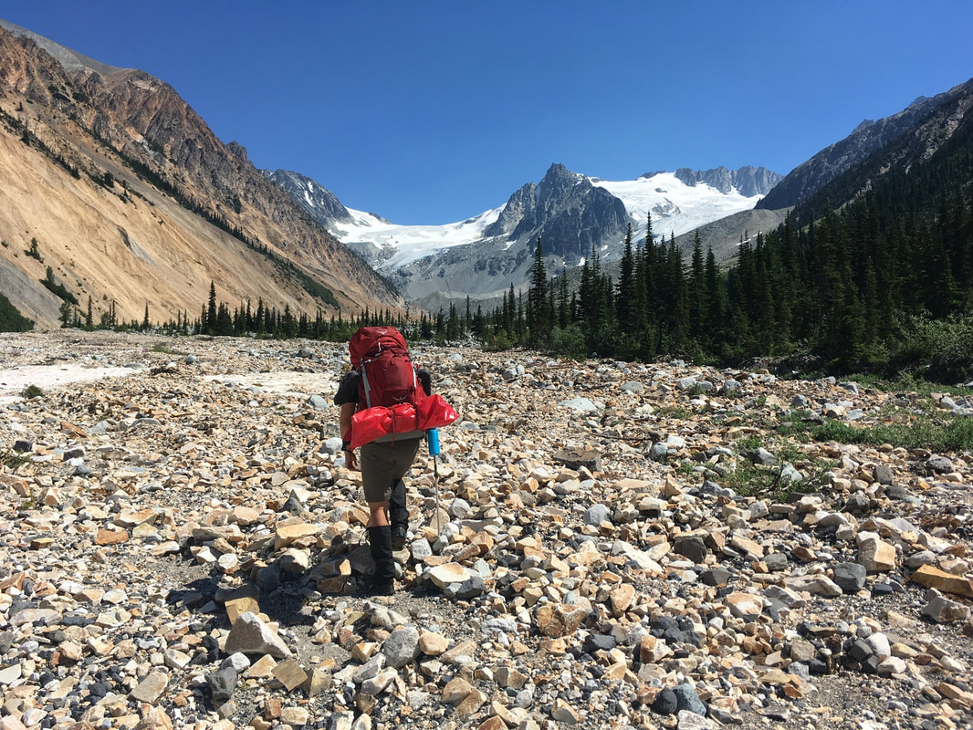
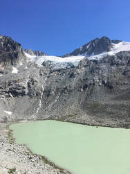
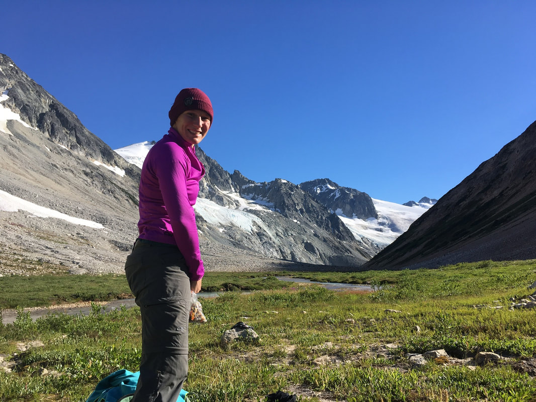
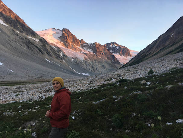
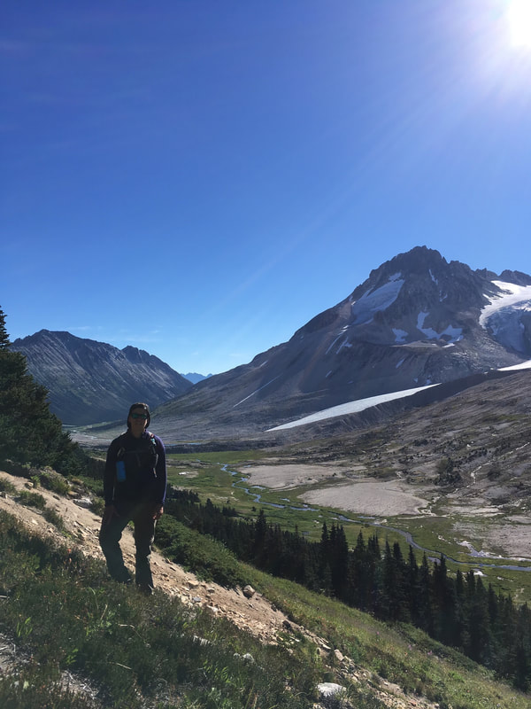
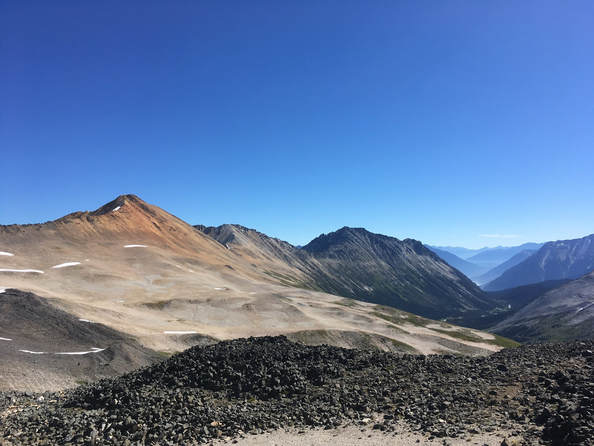
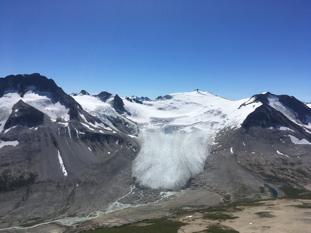
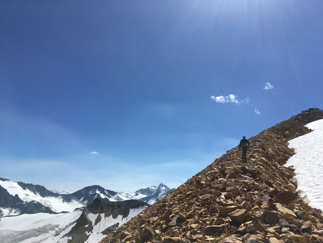
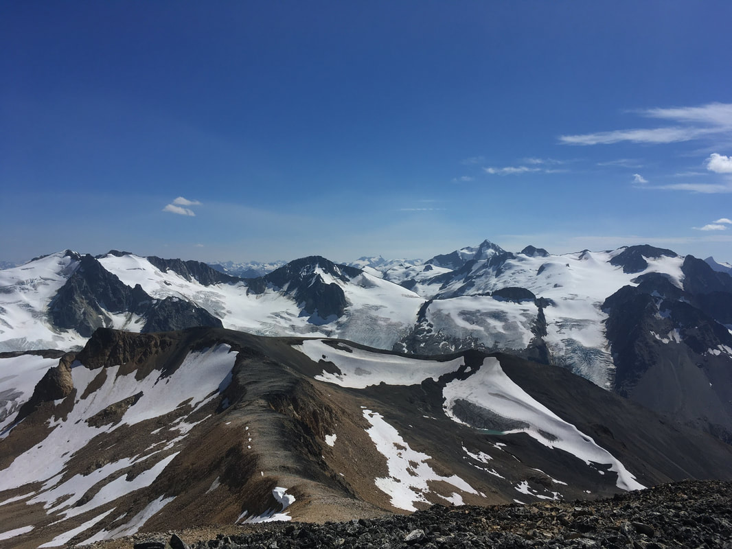
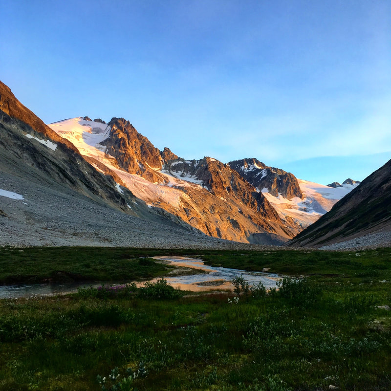
Once we started up again the river took a turn to the east. Now we could see the massive mountains and glaciers of Athelney Pass spilling their way down to the valley floor. It was absolutely stunning. It made the struggle worth it. We looked at the GPS and saw some flags that headed into the bush. Here we rejoined the proper route and began actually covering some ground. It wasn't long and we were out in the subalpine scrambling on boulders and shale. It was a scorching 38 degrees and I made Darryl stop with me so that I could collapse in the shade for a short while and close my eyes. After about 30 mins we got up and carried on. We passed some small lakes to our right and crossed a few more small creek branches as we gained our way to the pass.
The river crossing was a bit hairy, but not too bad. With slow movements and careful footing we both made it across and were only wet up to our knees. We walked for around another kilometre and found the beach again choked in by forest, this time on both sides of the river. I eyed the GPS, which showed the track on the other side of the river... However, now it was too deep to walk across... We made the decision to bushwhack on the west side of the river and look for another spot to cross farther up.
The going started off easy. An old growth forest with mossy ground and spread out trees. We made note that we were starting to climb high above the river, as the river bank turned into cliffs. I was relived when we started to head back down closer to the river again, but not for long. We walked into an old avalanche slide path full of thick alder and old log debris. It was horrendous. We could not see anything around us, including the ground. We decided to immediately head for the river and look for a place to cross.
When we arrived at the river we were literally hanging off of alder branches that grew right over the bank. Salal Creek was raging and it was far too unsafe to cross. I was stumped... I looked at Darryl for suggestions. We knew our only hope was to keep bushwhacking upwards and look for a safer place to cross. Going back would waste too much time. Thus, we headed back into the alder. It was NASTY. Trees so thick I could not see through and logs piled high on the ground. Getting through with my multi-day pack on was a struggle. At one point I fell down into what looked to be a swap and considered laying down to cry for a while. We were seemingly getting nowhere on an already long day.
When I snapped out of my sad state, I got up and pulled myself together. I looked around and saw light, knowing it would be the river bank. I called Darryl and made a dash for the opening. It was indeed a beach and the river still looked frightening, but not quite as bad as before. Once Darryl met up with me we both pondered where to cross. She was not feeling good about it, but we could see the the forest again choked in the beach a short distance up river. Therefore we picked a spot and went slowly one at a time. It was scary as heck and we were both soaked nearly up to the waste in raging water, but we made it. Once on the other side we sat down for our first break of the day and had lunch. We were 9kms in and it was around 1300.
Once we started up again the river took a turn to the east. Now we could see the massive mountains and glaciers of Athelney Pass spilling their way down to the valley floor. It was absolutely stunning. It made the struggle worth it. We looked at the GPS and saw some flags that headed into the bush. Here we rejoined the proper route and began actually covering some ground. It wasn't long and we were out in the subalpine scrambling on boulders and shale. It was a scorching 38 degrees and I made Darryl stop with me so that I could collapse in the shade for a short while and close my eyes. After about 30 mins we got up and carried on. We passed some small lakes to our right and crossed a few more small creek branches as we gained our way to the pass.
Views getting better!
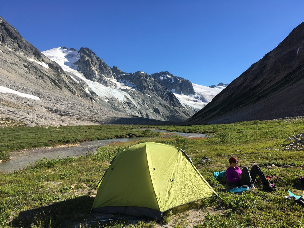
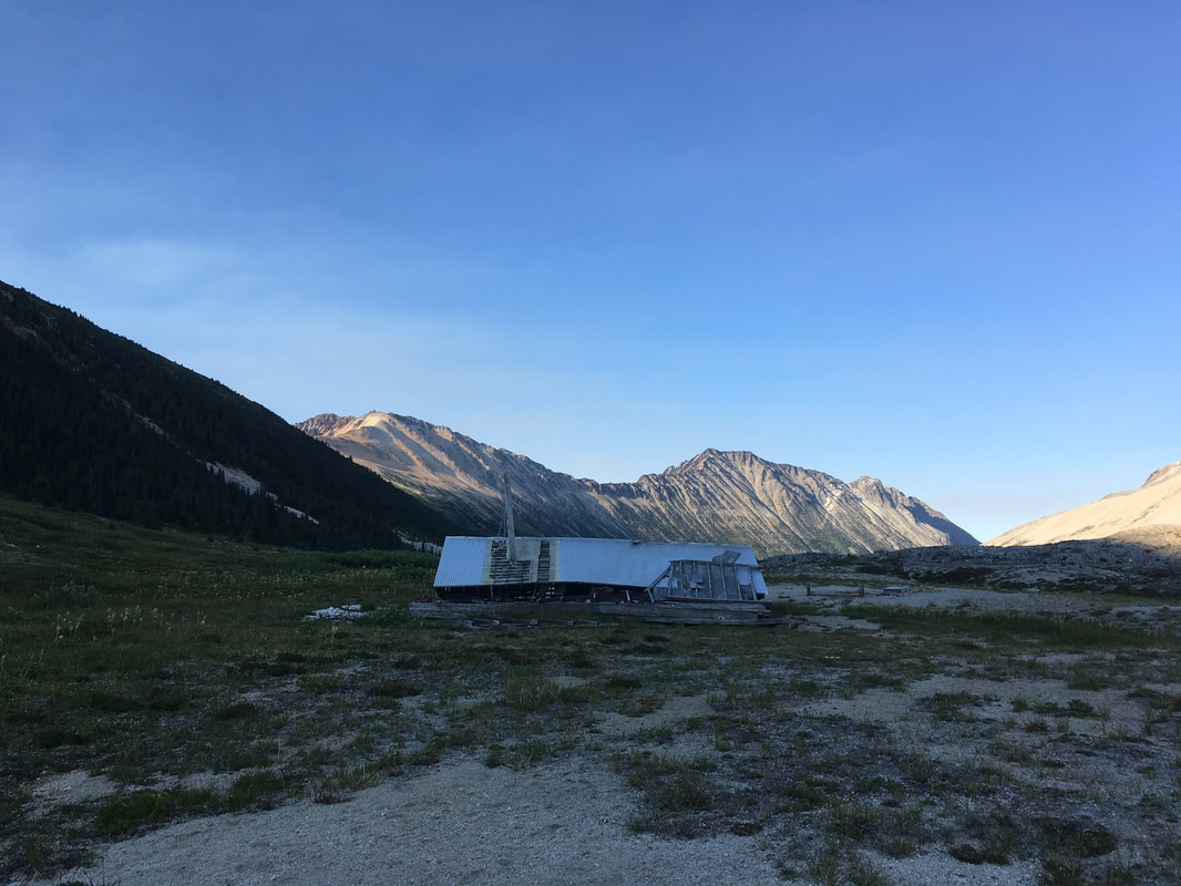
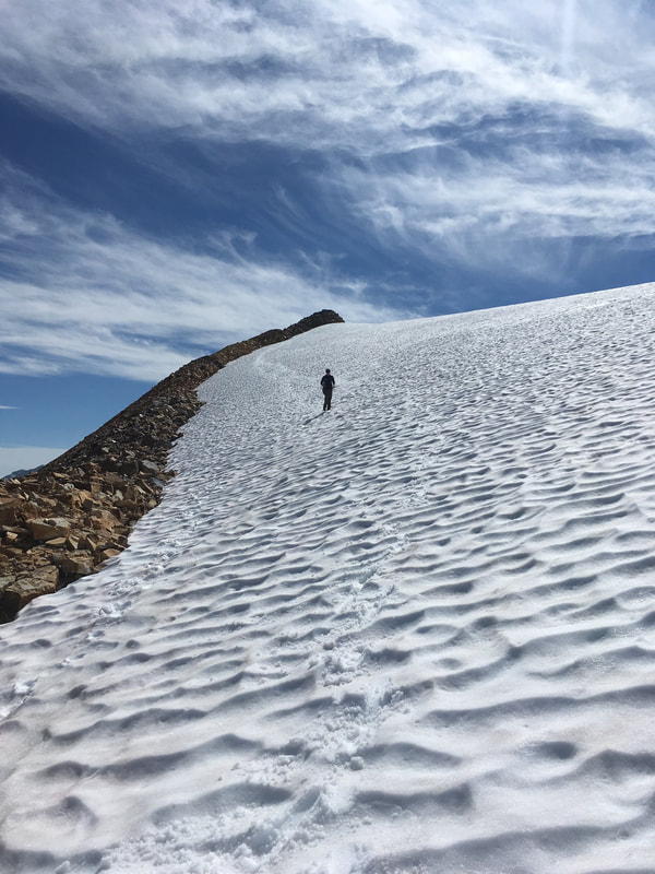
 Small lake on the way up 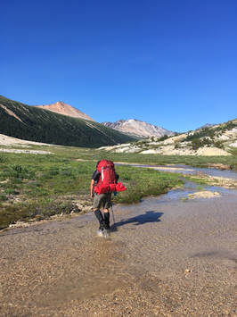 In the pass! | It was slightly slow going since this was the part of the route that we gained the most elevation. However, eventually we touched down off the rocks onto a squishy alpine meadow and knew we were nearing the conclusion of our day. The terrain eventually flattened out and we began to look for a place to pitch the tent. I had an idea of looking for the old mining cabin that most people camp at. However, I did not want to part with the view of the glaciers to the south, so we found a flat spot and set up camp. It was 1700, seven hours from when we started hiking. That evening we decided to carry on father up the pass to find an old mining cabin. It took us around 20 minutes of walking to arrive. The top of the pass was a bit boggy and we could literally see the terminus of the creek that flowed south one way and north in the other. The cabin was nothing more than an old roof. Unbelievable that they built a structure here in such a remote and exposed area. Once arriving back at camp the rest of the evening was like a dream. The alpenglow on the glaciers and mountains above had me fantasizing about sitting on their summits catching a cool evening breeze. The meadows and streams around us looked to be straight out of a fairytale. The sound of running water lulled me into sleep. |
 |  Camp with a view |
 |  Mining cabin |
Alpenglow in its finest
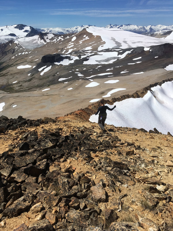
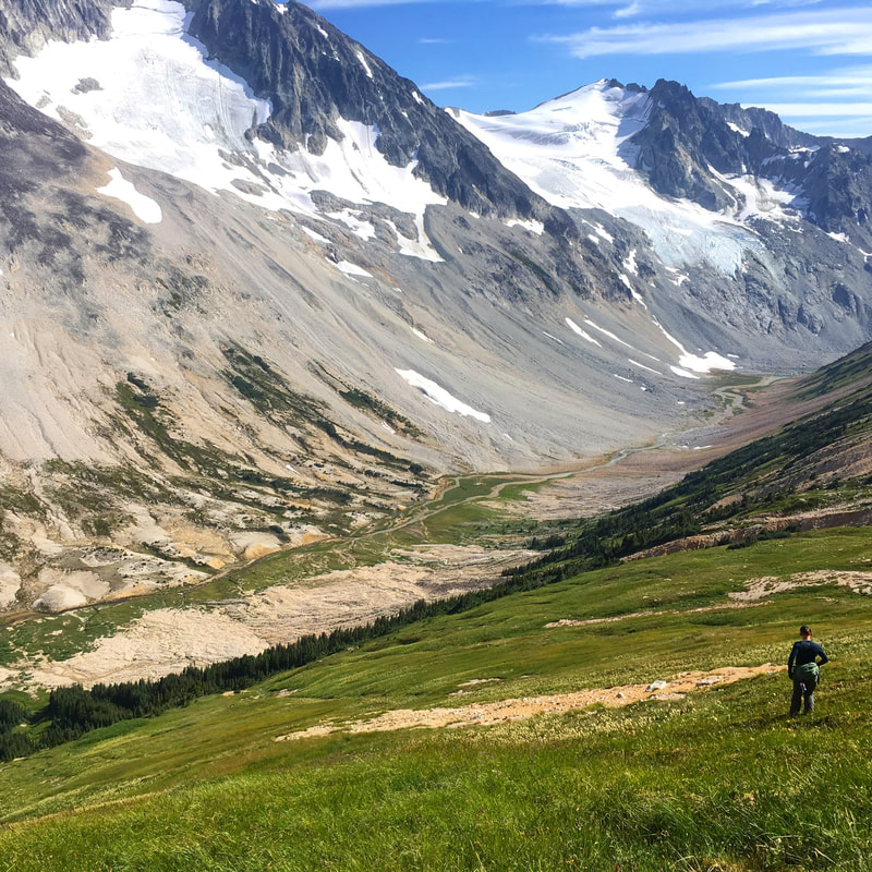
The next morning was again glorious. The sun had not quite risen when we emerged from the tent, and there was a crisp chill in the air. We made breakfast and completed all the morning chores before heading out for the day at 0930. The goal was to summit the Elephant Tusk, Ochre Mountain, and Salal Peak. We examined the hillside leading up from the pass. It looked grassy and inviting, but was covered in waterfalls cascading down from the snowfield. We made note of what looked to be the most efficient spot to climb up and turned our boots uphill. It was steep going, but we gained a lot of elevation in a short while and crested into the basin above.
While looking at the Elephant Tusk and considering a way up, we saw a large buck run by. I was shocked to see him so high up in the alpine. He looked majestic as he trotted past. We took in the first full view at what our day entailed, all three peaks, and I slightly doubted being able to climb all of the summits in one day. They were quite spread out. However, the Elephant Tusk looked to be a short-lived scramble up loose shale, so that is where we started. The mound was a neat old volcanic plug made of dark rocks, very similar to the Black Tusk, but on a much smaller scale. We made it up in no time. It was around 1030.
While looking at the Elephant Tusk and considering a way up, we saw a large buck run by. I was shocked to see him so high up in the alpine. He looked majestic as he trotted past. We took in the first full view at what our day entailed, all three peaks, and I slightly doubted being able to climb all of the summits in one day. They were quite spread out. However, the Elephant Tusk looked to be a short-lived scramble up loose shale, so that is where we started. The mound was a neat old volcanic plug made of dark rocks, very similar to the Black Tusk, but on a much smaller scale. We made it up in no time. It was around 1030.
 Gaining the basin 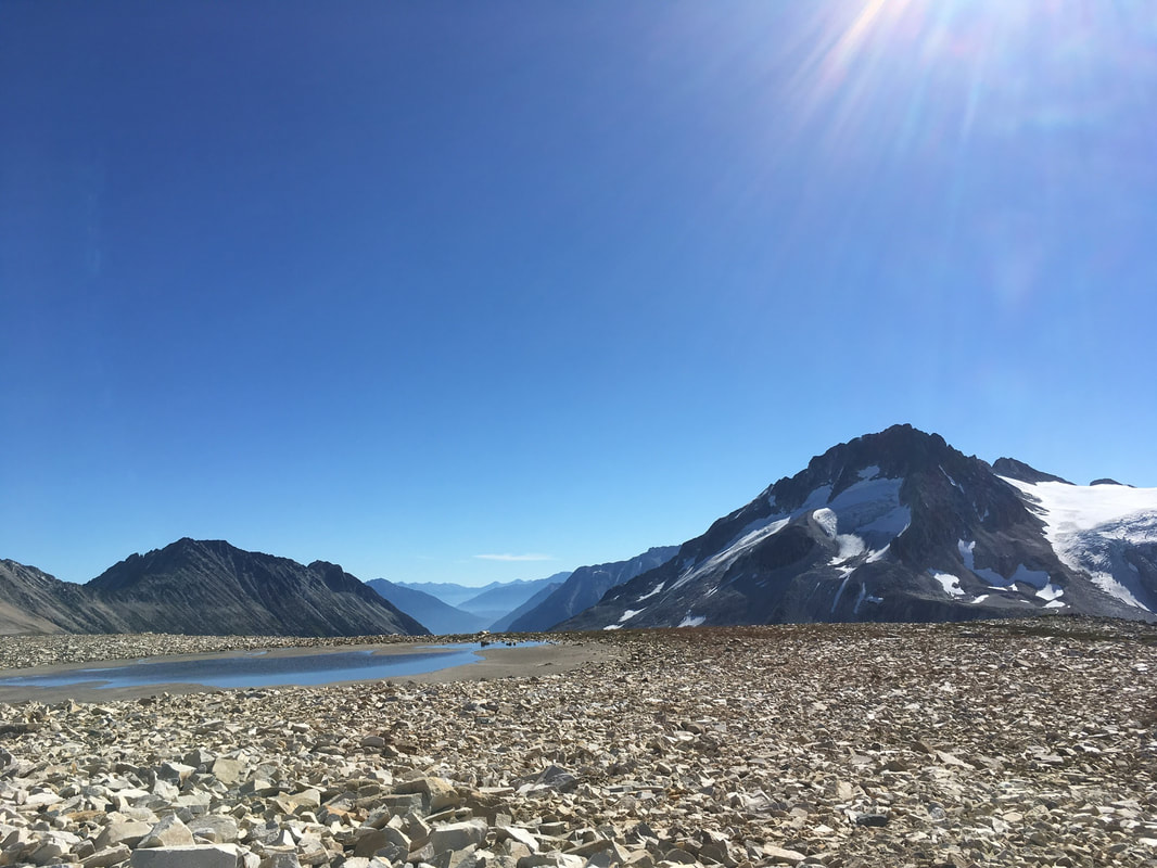 | 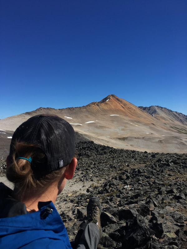 Ochre Mountain as seen from the Elephant Tusk |
View of Ochre Mountain
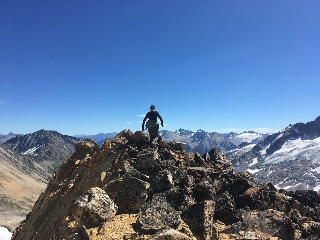
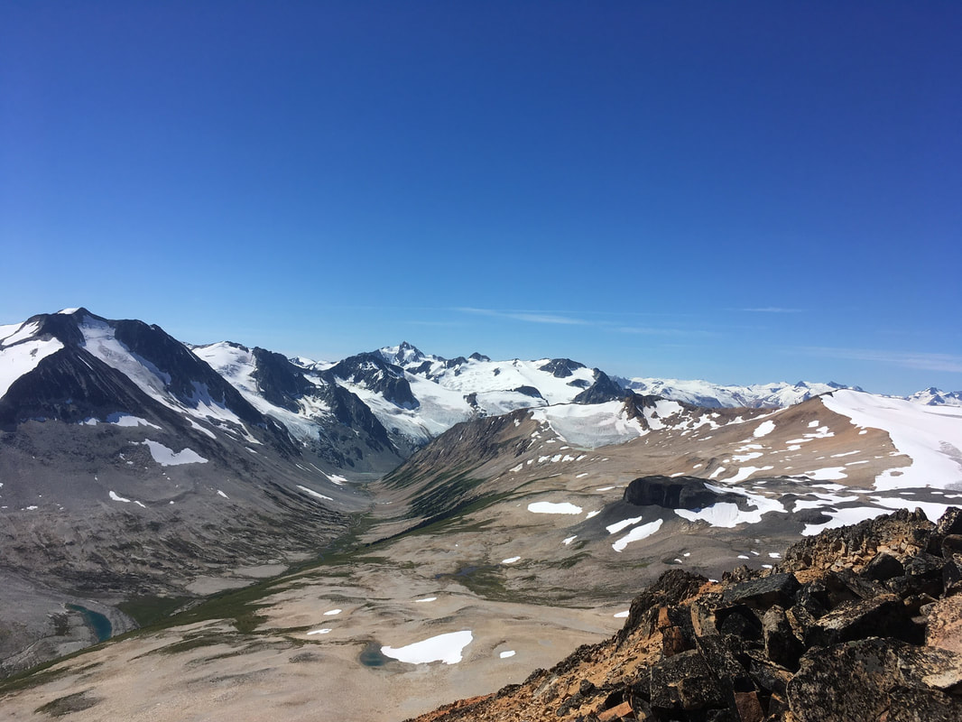
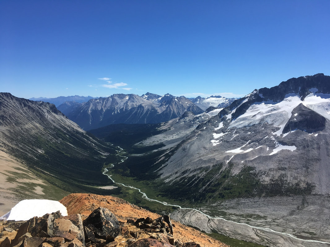
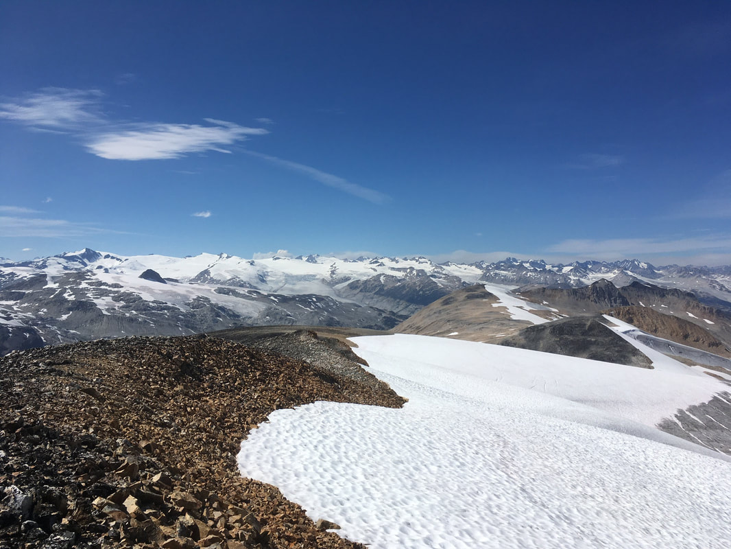
While up on the Elephant Tusk we had a couple snacks and planned our route up Ochre Mountain to the north. It looked to have a nasty loose shale approach as well, this time not so short-lived. Darryl and I disagreed on the route at which we should take, but set out together. We ended up combining both of our plans, traversing just below a long ridge that headed towards the summit. In the end it was not nearly as bad as it looked. We arrived at 1150. The summit was pretty exposed, large boulders piled high. The views here were unbelievable. We sat to have a longer break and some more food. We could now see the Icemaker Glacier in all its glory on the east side of the pass. The terrain over there looked pretty wild with so many glaciers and peaks running into each other. We were definitely on the more tame side.
Ochre Summit
View back down to Athelney Pass, the Elephant Tusk, and Salal Peak to the right (along the edge of the glacier)
From left to right: Mount Ethelweard, Icemaker Mountain and Glacier, Mount Guthrum.
Athelney Pass to the north. MacParlon Creek area.
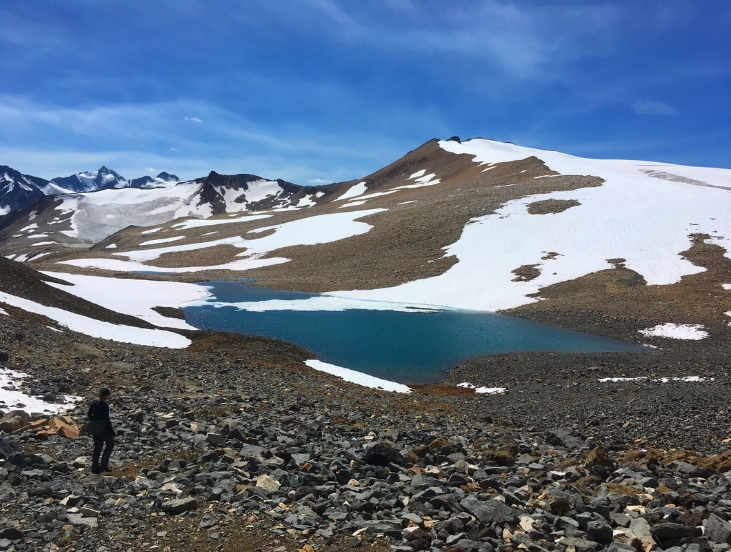
Finally, we headed back down for Salal Peak on the other side of the basin. We followed our tracks from the Elephant Tusk until we were back to the middle of the basin. Here there was a hidden lake we didn't notice on the way up. It looked refreshing and blue. Very inviting... But we had a summit to bag. Ochre had been at the north end of the basin and now we were heading to the south. Salal Peak appeared to have a glacier that we could avoid by skirting the rocks to the east and walking up a small ridge. We decided that we would examine snow quality for boot skiing in the way down.
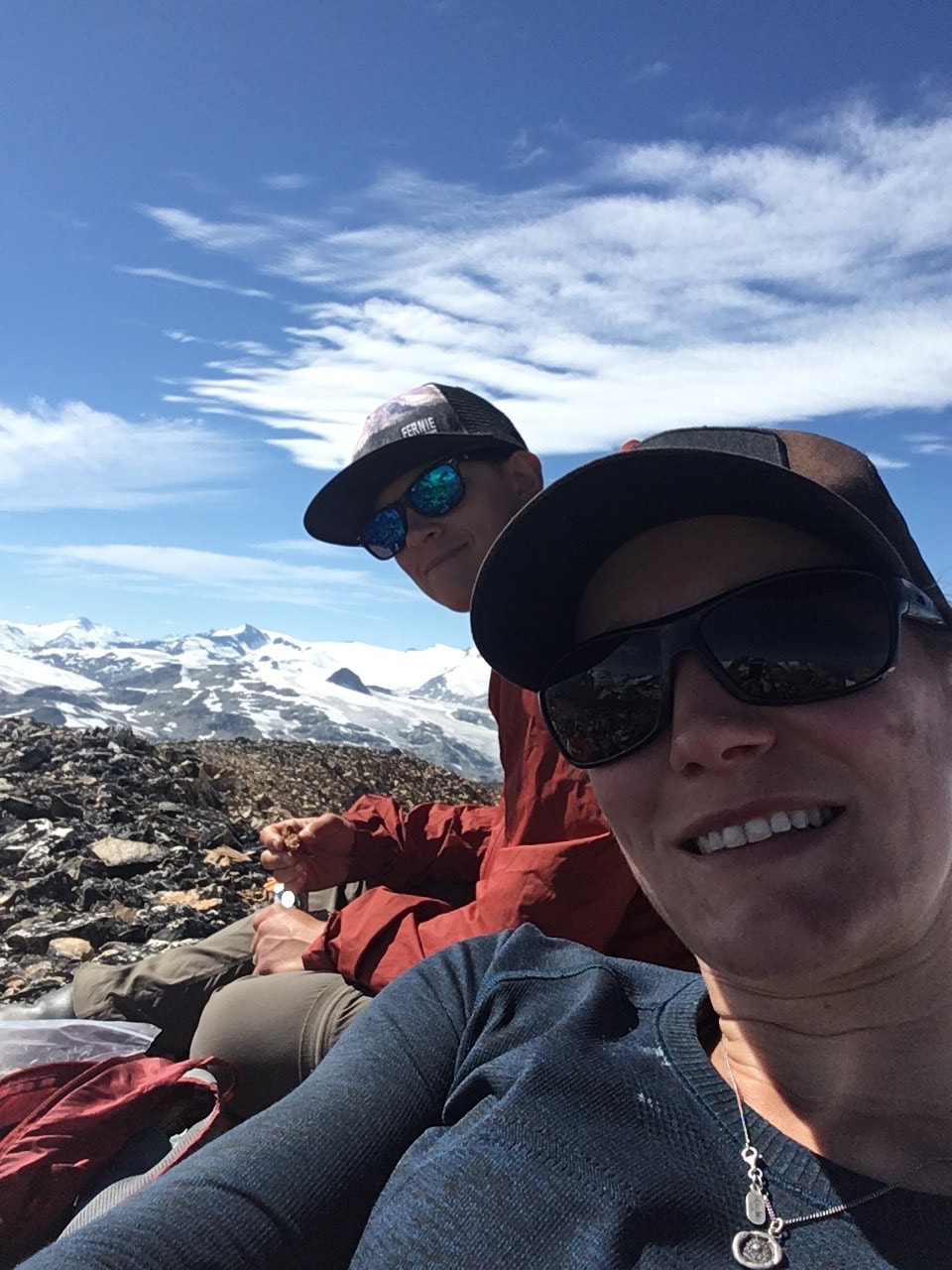
The walk on the ridge was shale, steady up hill, but not exposed. It was a hot afternoon and I was starting to feel like I wanted to be back at camp. However, we carried on up and arrived at our final summit of the day at around 1500. Small birds flitted around, intermittently landing on the glacier to scrounge for food. There was a nice cool breeze and we sat examining the many peaks in the Bridge Glacier area. The ice fields back there are the biggest I have seen.
The walk on the ridge was shale, steady up hill, but not exposed. It was a hot afternoon and I was starting to feel like I wanted to be back at camp. However, we carried on up and arrived at our final summit of the day at around 1500. Small birds flitted around, intermittently landing on the glacier to scrounge for food. There was a nice cool breeze and we sat examining the many peaks in the Bridge Glacier area. The ice fields back there are the biggest I have seen.
Salal in view and an inviting lake
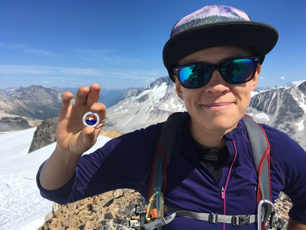
Tyax token on the summit
 |  |
Mount Athelstan and surrounding peaks
Boot Ski down
Camp is down there somewhere
After some more snacks and a couple espresso beans to get me motivated we headed back down to camp. The going was fairly slow over the loose shale, but we used the glacier to boot ski along the edge and found a couple snow patches to link up on the way down to the lower basin. Here we rejoined our route up from the pass below. We picked a chute, mainly full of dirt so that we could continue our boot skiing method. Dirt and scree skiing is always a good time. However, Darryl lost control at one point and landed ass first onto a rock... There was some intermittent laughing and moaning, but she was mostly unharmed. She was more sad about the dirt on her last clean clothes.
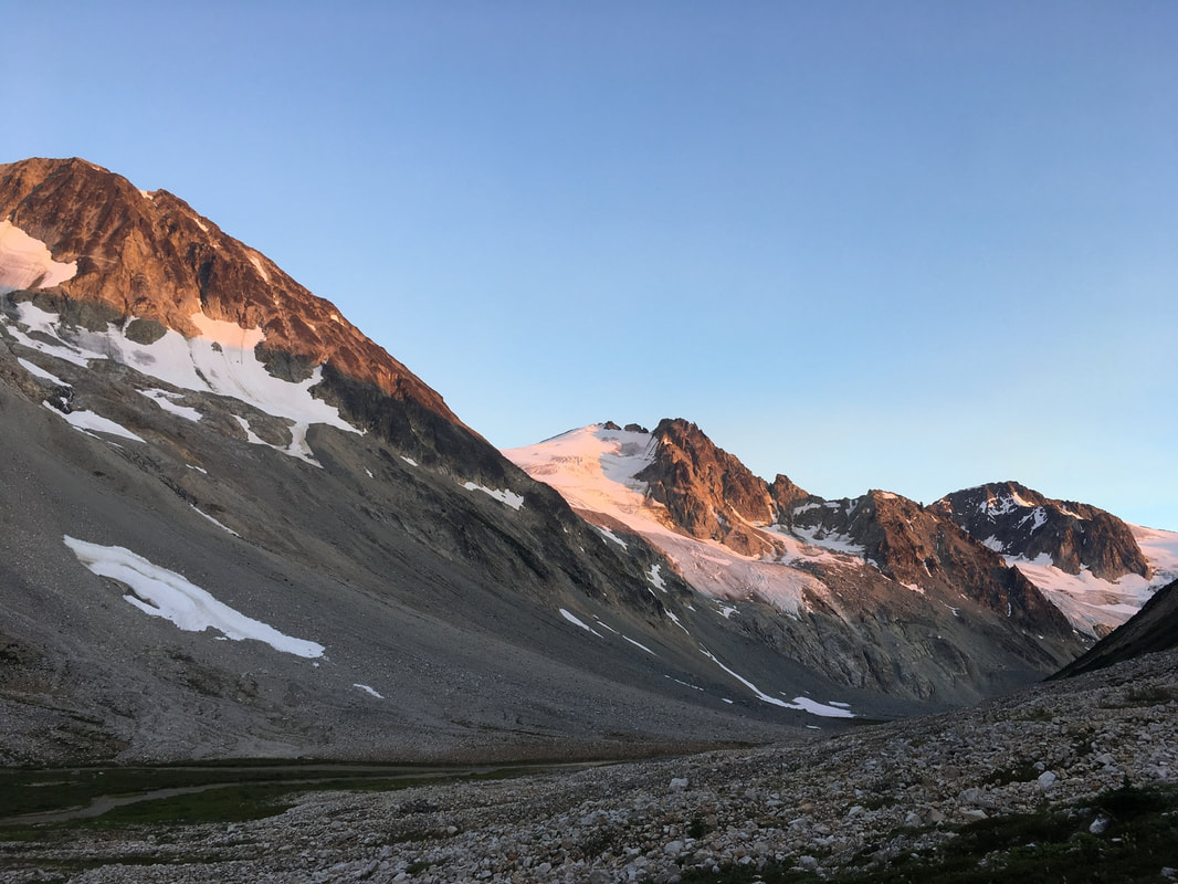
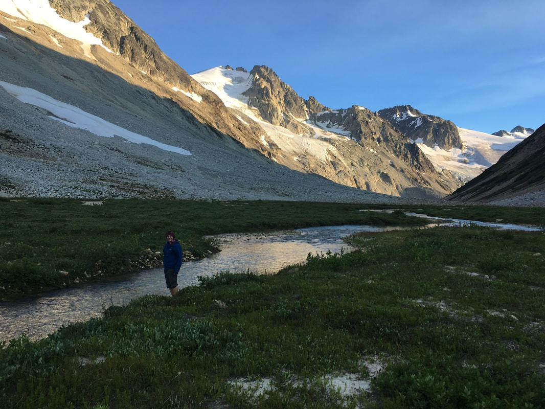
Without further incident we arrived back at camp around 1630. It was a long day, but we briefly considered hiking our camp down lower to save time for the hike out the next day. However, I could not part with the mesmerizing view of the glaciers. We instead did our usual camp choring and then settled in for an evening sipping beer that Darryl had hauled up and some spiced whisky. We watched massive boulders give way and trundle town the glaciers as the heat from the day caused them to release. What a time. As the evening wore on and it was time to retire to the tent I couldn't pull myself away from the view. I slept with the tent fly open and watched the alpenglow slowly fade into dusk.
Without further incident we arrived back at camp around 1630. It was a long day, but we briefly considered hiking our camp down lower to save time for the hike out the next day. However, I could not part with the mesmerizing view of the glaciers. We instead did our usual camp choring and then settled in for an evening sipping beer that Darryl had hauled up and some spiced whisky. We watched massive boulders give way and trundle town the glaciers as the heat from the day caused them to release. What a time. As the evening wore on and it was time to retire to the tent I couldn't pull myself away from the view. I slept with the tent fly open and watched the alpenglow slowly fade into dusk.
More alpenglow...
The next morning it was time to pack up and GTFO. It was my birthday and I was looking forward to food from The Pony and beer from Pemberton Brewing Co. We packed up camp and left with haste. The going was slow and annoying over shale... We made our way down to a giant moraine and climbed up to follow it down for a ways. Here we witnessed more rock fall and I was thankful that we didn't decide to camp here. It would have been alarming to hear the rocks falling so close to camp...
It seemed in no time we were at the bend in the river we had crossed on the way up. This time I watched the GPS closely and we found flags heading into the forest. The flags were hard to spot at times, but followed a good route that kept us from being wet or stuck in alder. In fact they headed a considerable distance inland and eventually through an old slide path. This time however someone had put some real thought into the route and even cut a few trees. It was so much less exhausting then the route we had chosen. I felt silly for not following the GPS on the way up.
We were making record time and popped back out on the beach of the river where we had made our terrible mistake to cross over on the way up. I figured we were over half way and decided to stop for a snack. I soaked my hat and shirt in the river before carrying on. Now the route headed back into the forest again. It was a decent route, and there were plenty of berries... Or should I say BEARries... We yelled loudly just incase. Probably for the best because there were some claw marks in a tree about 7 ft in the air...
 Bear claws... Some fresh, some old about 7ft up.... | Again we popped out onto the beach and this time it as very hard to find a trail. We picked what looked to be a booted path, but it disappeared into a swamp. The alders were thick, but the GPS said we were right on route. I imagined we should most probably be somewhere up in the forest above... It was again tough going, but we powered through and came out on the other side unharmed. We were now on the last stretch of beach walking. It was tough. My legs were tired and a bit shaky, but we knew we were close to the end. To our joy we found a trail that cut into the woods. It was well booted and flagged. This took us all the way to the logging road and we could see where we missed the trail right off the bat. There was some deadfall that obscured our view... Oh well, we had an adventure to remember. We made it back to the truck in just under 6 hours. The drive out was definitely worth mentioning. The road is fantastic. However, there is a gate just west of the Hurley Road that is locked when the temperatures hit the high 30's. We were not aware of this, and there was no signage on the way in to warn us. On the way out we found ourselves trapped behind the gate, and to top it off I popped a tire. We changed the tire and to our luck some workers arrived that had a key. Apparently the gate is locked for high temperatures because of the rockfall and landslide hazard that exists from Meager Creek. Very understandable considering the rockfall we witnessed. The trip indeed ended as planned with tasty food and beer. We chatted up some locals at the brewery that confirmed why the gate is closed at times. The risk of a massive landslide is a real issue. Cheers until the next adventure! |
 RSS Feed
