Mount Seton is the highest mountain in the Cayoosh Range sitting at 2855m. It is the highest point along Seton Ridge that divides the Downton drainage from Lost Valley and Seton Lake. This peak has been on my list because I have seen it from a distance many times hiking up Downton and along Seton Ridge. There are a couple approaches. One example being a traverse from Seton Ridge trail/Seton Ridge Road. This would certainly take some time as it is a long ridge. The other route, that we settled on, was an approach from Downton and the drainage that comes down from Saddlebag Lakes. Here there is a rough trail made by some Lillooet locals that is in need of some love with many downed trees. It is the shortest approach and starts at around 1350m, which is appealing.
Darryl and I set off for this peak two days after getting home from an epic road trip of hiking, running, and climbing. I was feeling a bit tired and unsure how this summit attempt would go. I wasn’t sure how it would be crawling out of the bowl from Saddlebag Lakes being that google maps was hard to assess. The weather was cloudy and looked a bit tempermental. We wore our running vests and shorts as I didn’t really think mountaineering gear would be required. We arrived and started hiking around 0830 or so.
The trail started off in an old logging slash on the west side of a creek and would be a bit tricky to pick up if you hadn’t been there previously. Luckily I had done this once before. Shortly into the hike we started to see obvious flagging and headed out of the slash and into the forest. Here we began climbing over, under, and around a number of downed trees. It was sad to see just how many had come down in the year since I had hiked here previously.
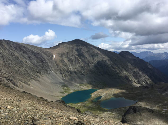
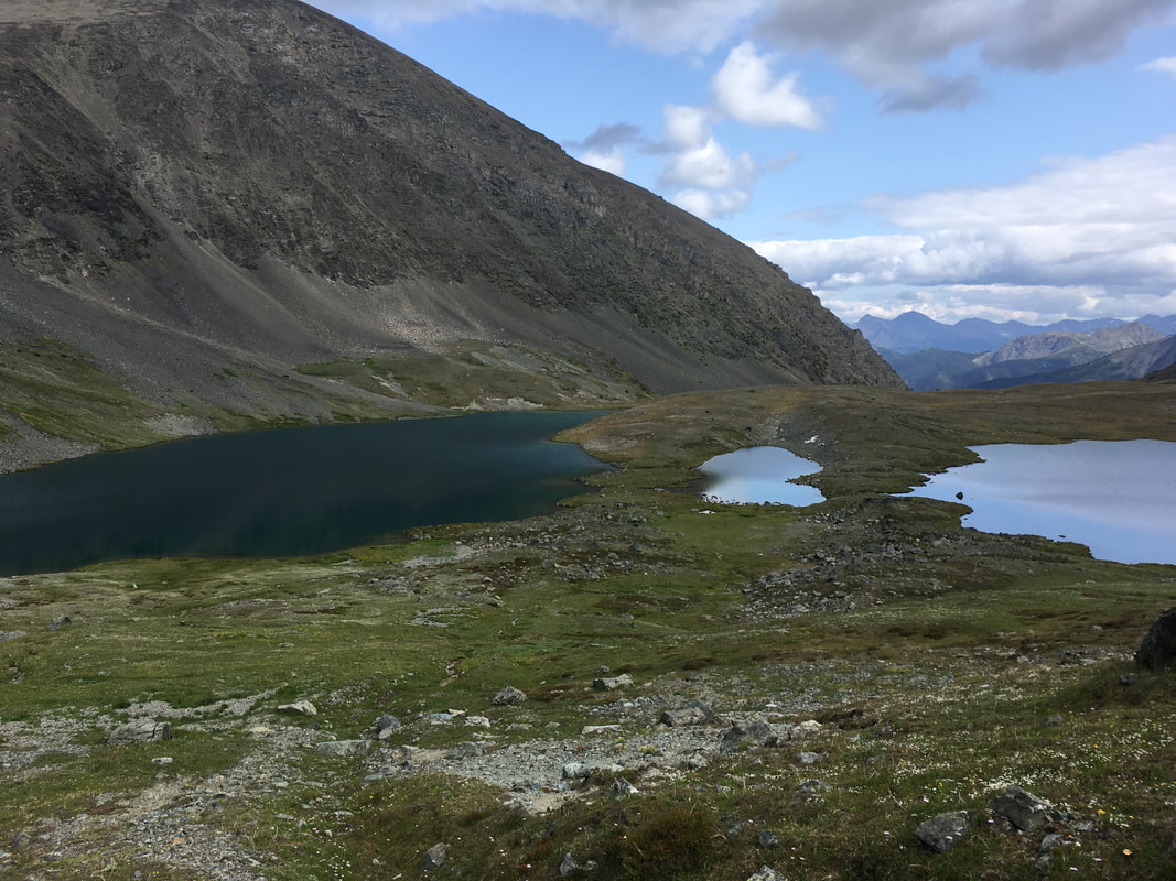
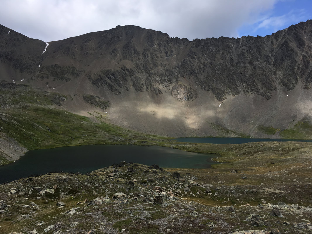
The trail followed along the creek and slowly climbed up towards the alpine. We passed through more forest, scree slopes, and dried creek beds. The trail always stuck on the west side of the creek. Eventually we arrived in an alpine meadow and I started to feel like we were getting somewhere. I eyed the GPS since I had not been past this point. It showed that we still needed to climb up another bench to where Saddlebag Lakes sat. We climbed steeply up a scree slope and finally could see the lakes. They were crystal clear and blue. Very unique looking arrangement of lakes in the shape of saddle bags! This is a very large bowl that would provide some nice camping or just a day trip in itself. From here it was hard to tell which peak was actually Seton. When looking again at the GPS is appeared it was right above the lakes and not actually further to the west, which from that point looked to be the higher.
Darryl and I set off for this peak two days after getting home from an epic road trip of hiking, running, and climbing. I was feeling a bit tired and unsure how this summit attempt would go. I wasn’t sure how it would be crawling out of the bowl from Saddlebag Lakes being that google maps was hard to assess. The weather was cloudy and looked a bit tempermental. We wore our running vests and shorts as I didn’t really think mountaineering gear would be required. We arrived and started hiking around 0830 or so.
The trail started off in an old logging slash on the west side of a creek and would be a bit tricky to pick up if you hadn’t been there previously. Luckily I had done this once before. Shortly into the hike we started to see obvious flagging and headed out of the slash and into the forest. Here we began climbing over, under, and around a number of downed trees. It was sad to see just how many had come down in the year since I had hiked here previously.
The trail followed along the creek and slowly climbed up towards the alpine. We passed through more forest, scree slopes, and dried creek beds. The trail always stuck on the west side of the creek. Eventually we arrived in an alpine meadow and I started to feel like we were getting somewhere. I eyed the GPS since I had not been past this point. It showed that we still needed to climb up another bench to where Saddlebag Lakes sat. We climbed steeply up a scree slope and finally could see the lakes. They were crystal clear and blue. Very unique looking arrangement of lakes in the shape of saddle bags! This is a very large bowl that would provide some nice camping or just a day trip in itself. From here it was hard to tell which peak was actually Seton. When looking again at the GPS is appeared it was right above the lakes and not actually further to the west, which from that point looked to be the higher.

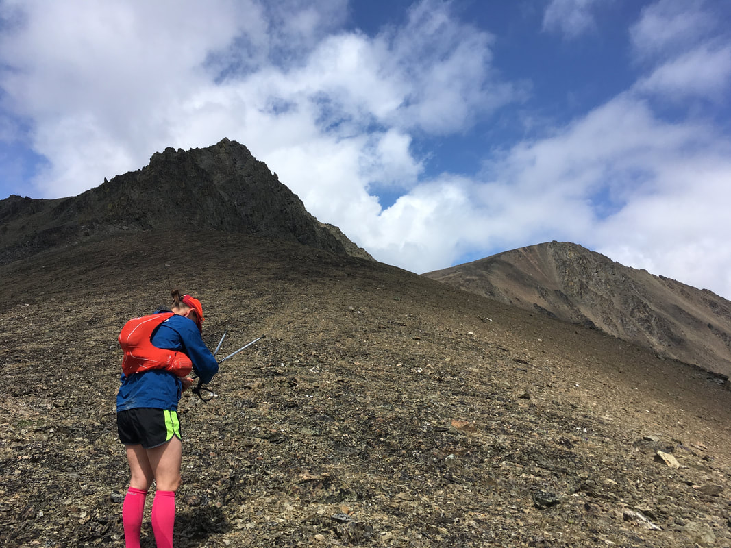
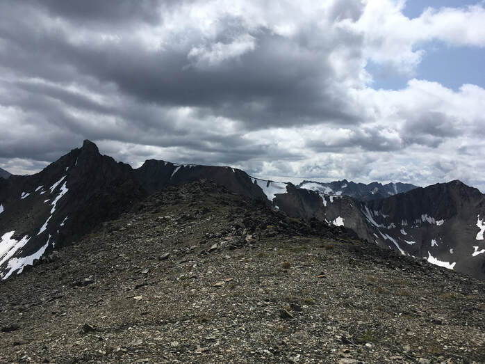
Climbing out of the bowl
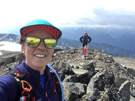
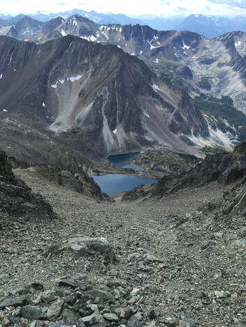
Cresting the ridge, looking towards the sub-peak and Seton
We hummed and hawed about which approach to take out of the bowl to gain the ridge leading to the summit. The entire thing was rimmed with steep shale and cliffs. It appeared that there was a small ramp to the left of the western sub-peak, so we set off to give it a try. I assumed we could just walk up and over the sub-peak and carry on to the summit of Seton. Once we got closer to the sub-peak I could see that it was a bit more then we bargained for, flanked with steep chossy rock. We carried on anyways and summited the ridge. The shale on the way up was loose and nasty. Crumbling and sliding out with every step.
Once atop the ridge we had a quick snack and changed layers. I eyed the sub-summit and deemed it too sketchy to climb over. We decided to traverse around the north side and gain the saddle below Seton further along. This way certainly had its challenges, including plenty of hair-raising loose rock that could not be trusted. Careful and slow footing was required to negotiate our way around.
Once on the saddle I took a big breath and set my sights for the summit. I could see some nasty weather, including lightening, brewing to the north and coming our way so we quickened our pace. We arrived at the summit to find a register with minimal entries from the last couple years. It included an entry from some seasonal Lillooet monks! Those guys are everywhere! We had a quick snack and set back off towards home.
Saddlebags from the summit
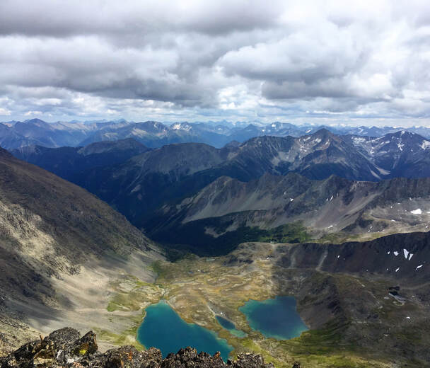
 View to the north | The weather was moving in quick and I was preparing for a downpour. I just wanted to be of the ridge and into the trees. Darryl suggested that we opt to just so straight down along a waterfall that comes off a small patch of snow at the saddle. She actually wanted to take this route up, but I didn’t think it looked good. At this point it looked outstanding! We scree-skied and climbed down more loose rock. While this route was steep, it was very direct, and we arrived back down in the bowl in no time! It also appeared that the weather was passing just to the west and missed us ever so slightly. Here we found some quartz crystal that was just beautiful. We spent some time collecting a few pieces to take home. We walked along the edges of the lakes here and admired their beautiful blue/green colour. On a hot day it would be fantastic to take a dip. Not long later I stopped to pee before we descended out of the bowl. When I looked up I could see other people heading our way! Oops! They were two boys from Vancouver. They had little to say and didn’t seem keen on our advice to avoid the sub-summit and go direct up along the waterfall. Their plan was to camp on the summit… We carried on. |
Back down through the meadow and into the forest we went. Further down along the creek we ran into another two boys, also from Vancouver. They were much more chatty and said that they were planning on traversing over towards Holly Lake. I thought this was a great idea. The terrain here is very easily travelable one you are out in the alpine.
After 6h45min round trip we made it back to the truck. In total we gained around 1500m and travelled 16k. We lucked out and avoided the rain and lightening. Until next time!
After 6h45min round trip we made it back to the truck. In total we gained around 1500m and travelled 16k. We lucked out and avoided the rain and lightening. Until next time!
 RSS Feed
