 | Not long after moving to Lillooet I developed a desire to hike the length of Mission Ridge. Something about walking in the alpine high above Seton Lake sparked my interest. The area is mainly rugged and untouched by humans. It requires navigation since no trails or formal routes exist. Most locals I have talked to have never walked the length of the ridge, but have been on small sections. However, an RCMP friend of ours hiked the length of the ridge in 2016 and again in 2017 with a conservation buddy. Therefore, we knew it was possible! |
Day 1: Mission Mountain Pass to Mission Peak
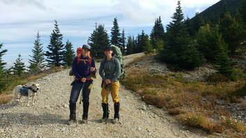
We decided to cover the 35km route from Mission Mountain Pass close the communities of Seton Portage and Shalath back to Lillooet in one night. We convinced a nursing friend of ours to drive us out in our truck and drop us off. It was a bit weird saying goodbye knowing that there was no turning back once she drove away. We would be walking home. We set off on foot up to gain the top of the ridge at 0930.
The weather was a bit growly. There were some clouds and a cold wind blew, which was a change from our scorching 30+ weather in Lillooet for most of the summer so far. We gained the first high point of the ridge as mentioned in a local hiking book. To this point there is an obvious road and trail. The summit is covered in old weather equipment smashed up and long abandoned. Down below us Seton Lake glowed a beautiful green blue and Anderson Lake could be seen on the other side of Seton Portage. We walked along and shortly after had to drop down off the ridge to avoid a few cliffs that looked quite impassable when viewed on Google Earth and now in real life. Here we heard rocks falling somewhere ahead and became a bit unnerved. It didn't take long to eventually spot the silhouette of our first great horned sheep. He stared at us for some time and then took off somewhere over the cliffy rocks.
The weather was a bit growly. There were some clouds and a cold wind blew, which was a change from our scorching 30+ weather in Lillooet for most of the summer so far. We gained the first high point of the ridge as mentioned in a local hiking book. To this point there is an obvious road and trail. The summit is covered in old weather equipment smashed up and long abandoned. Down below us Seton Lake glowed a beautiful green blue and Anderson Lake could be seen on the other side of Seton Portage. We walked along and shortly after had to drop down off the ridge to avoid a few cliffs that looked quite impassable when viewed on Google Earth and now in real life. Here we heard rocks falling somewhere ahead and became a bit unnerved. It didn't take long to eventually spot the silhouette of our first great horned sheep. He stared at us for some time and then took off somewhere over the cliffy rocks.
 Down climbing off the ridge to avoid cliffs | 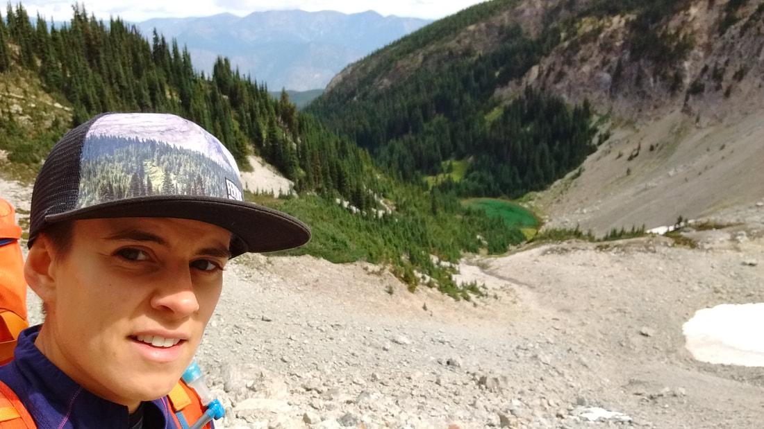 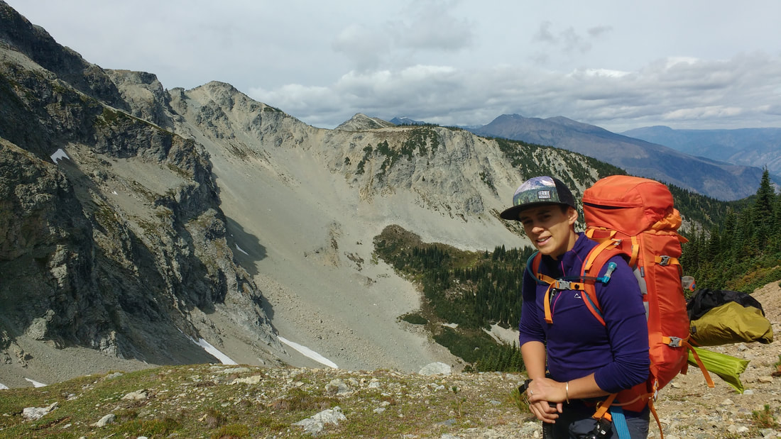 We down climbed the talus slope behind me |
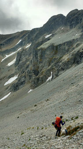
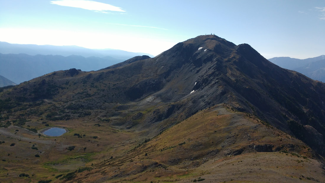
We stayed low on some annoying talus slopes and eventually had to drop considerably almost to the level of a small lake before climbing back up. It seemed to be slow going, but really only took us about 45 mins of a detour. Once we regained the ridge our route unfolded before us. Kilometres of beautiful ridge walking awaited us and we could see Mission Peak- or the Mission Tooth as some locals like to call it.
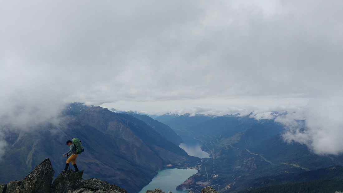
From this point the walk was very enjoyable. Views opened up of the surrounding mountains including Seton Ridge, Mount Seton, Melvin Peak, Whitecap Mountain, and Mount Brew to name a few. Seton Lake was far below and we could see boats playing on the water. To the north we could see the odd old road coming up from the Bridge River Valley and rarely visited alpine lakes. The going was fairly good except a few spots where we dropped down onto talus to avoid exposure. Looking back we could have probably stayed higher up in many of these spots. We followed the many goat and sheep paths that cover the ridge. Most times it seemed the best way.
From this point the walk was very enjoyable. Views opened up of the surrounding mountains including Seton Ridge, Mount Seton, Melvin Peak, Whitecap Mountain, and Mount Brew to name a few. Seton Lake was far below and we could see boats playing on the water. To the north we could see the odd old road coming up from the Bridge River Valley and rarely visited alpine lakes. The going was fairly good except a few spots where we dropped down onto talus to avoid exposure. Looking back we could have probably stayed higher up in many of these spots. We followed the many goat and sheep paths that cover the ridge. Most times it seemed the best way.
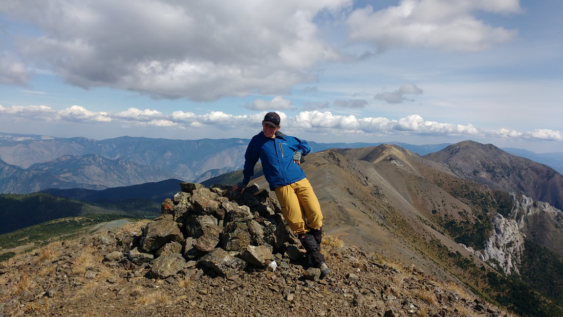
Standing on Mission Molar with Mission (tooth) Peak behind
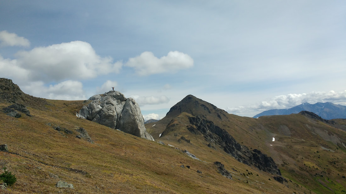
Before we arrived at Mission Peak there was a unique limestone feature jutting out from the landscape. I named it the Mission Molar, because it resemble a molar tooth standing out stark white against the ridge. I quickly hiked ahead so that Darryl could get a few pictures of me standing on top.
Very shortly after this we dropped our bags and headed up to summit Mission Peak before heading down to where we would camp. The hike up was a bit of a scramble, but nothing too scary. The dog was able to make it up without an assist. It was just before 1500 and we stopped for a snack.
Very shortly after this we dropped our bags and headed up to summit Mission Peak before heading down to where we would camp. The hike up was a bit of a scramble, but nothing too scary. The dog was able to make it up without an assist. It was just before 1500 and we stopped for a snack.
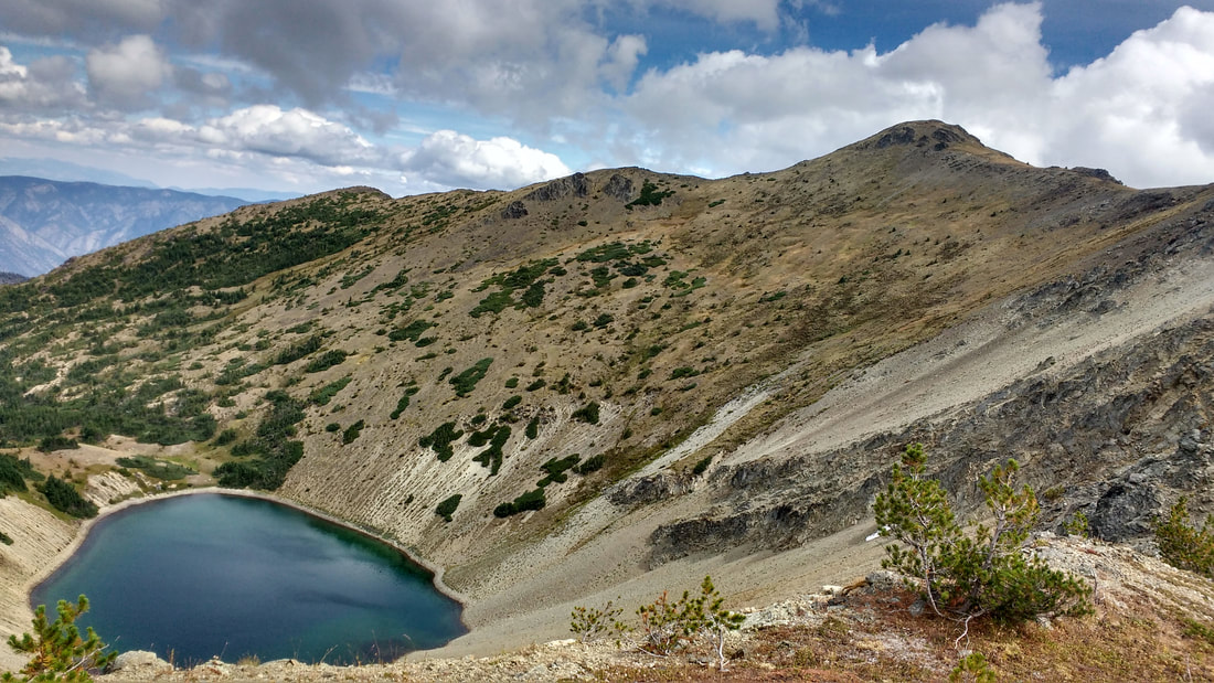
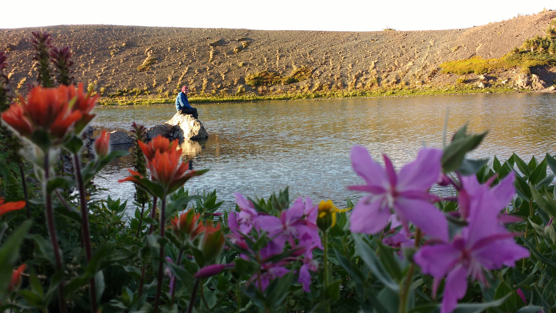
After dropping down back to our packs we carried on slightly further before heading down off of the ridge onto a small plateau with a beautiful lake for the night. The soil and rocks were all different colours. Some places orange, brown, green, blue, and dark grey. The small lake where we would set up camp was a light greenish blue. There were many signs of animals here. Sheep, goat, wolf, and bear tracks littered the ground around and inside the lake. Clearly this was one of the few sources for watering this area. We pitched our tent on a small peninsula on the lake.
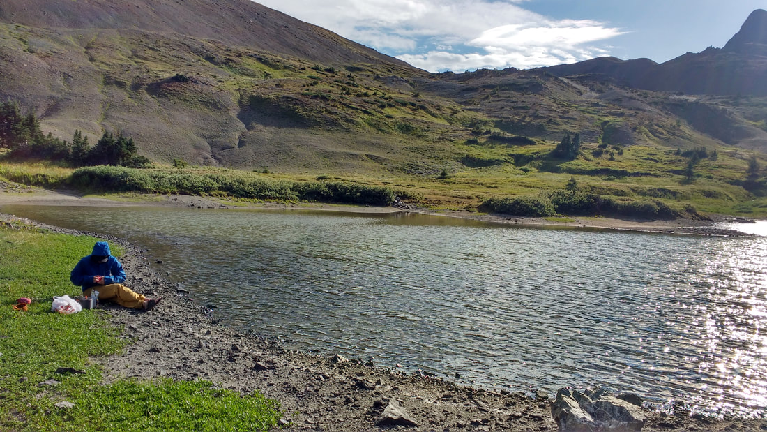
We arrived rather early and so Darryl read her book to Beans and I who did not pack one. We relaxed and I may have even fallen asleep briefly while passing time. Eventually we made dinner, cleaned up camp, drank a beer, and tucked in for an early bedtime.
We arrived rather early and so Darryl read her book to Beans and I who did not pack one. We relaxed and I may have even fallen asleep briefly while passing time. Eventually we made dinner, cleaned up camp, drank a beer, and tucked in for an early bedtime.
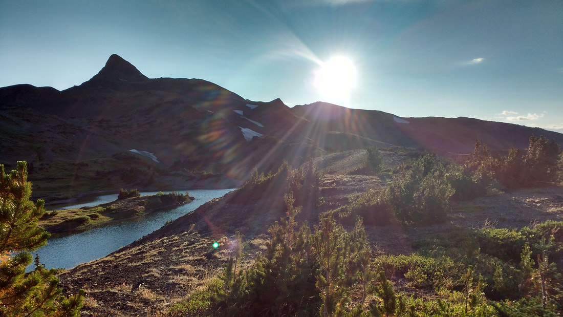
 Heading to camp | 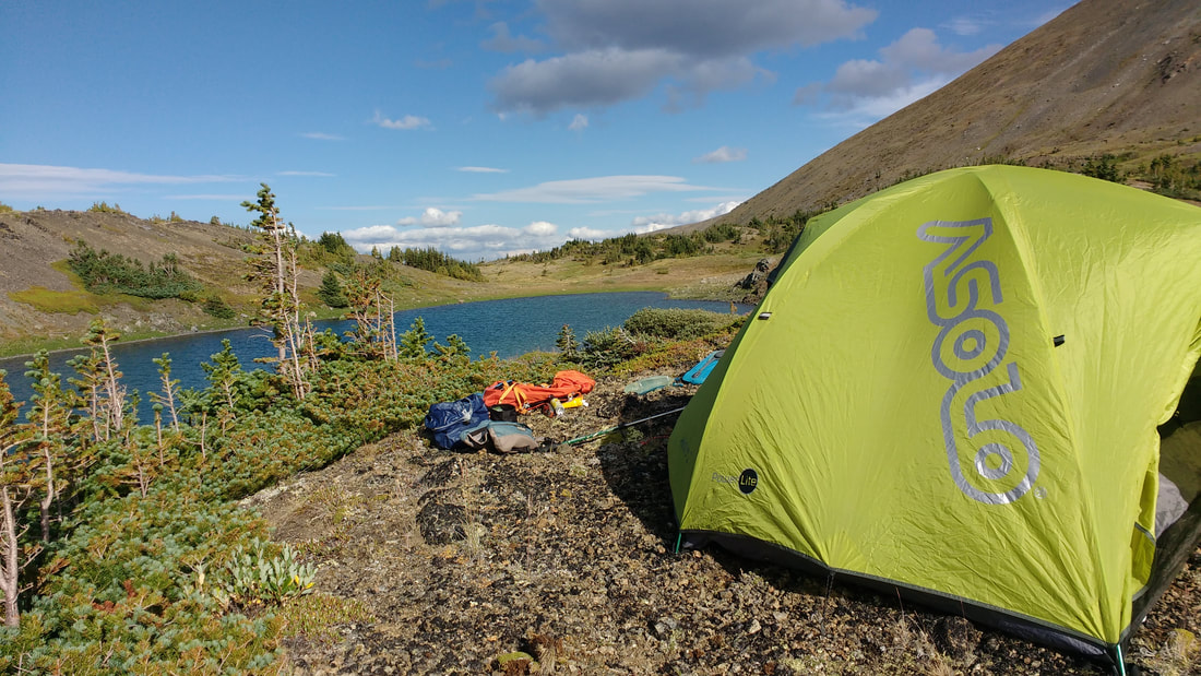 |
Can you spot our green tent on the peninsula?
Day 2: Mission Peak to Lillooet
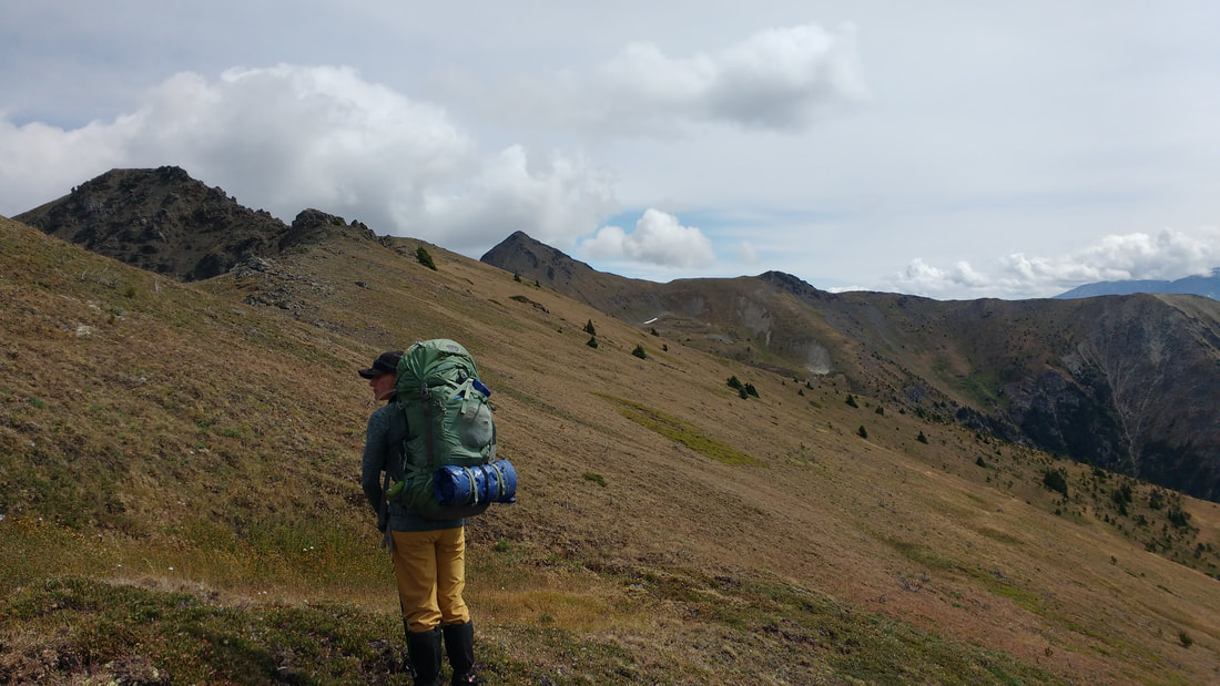
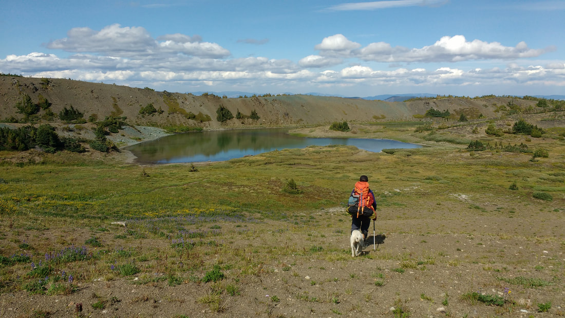
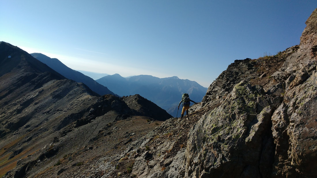
The next day we awoke slightly before 0600 to clear blue skies. We crept out of the tent and began the process of making breakfast and packing up. By the time we were back up on the ridge it was 0800. Now we set our sights on Mount Mclean- our final summit. There were three peaks to summit on the ridge prior to Mclean and we oscillated up and down about 300-400m with every one. We could see Moon lake down below us. We always stuck to the highest point of the ridge following goat paths despite it sometimes looking sketchy from a distance. To our luck it was always the best choice. Goats know best!
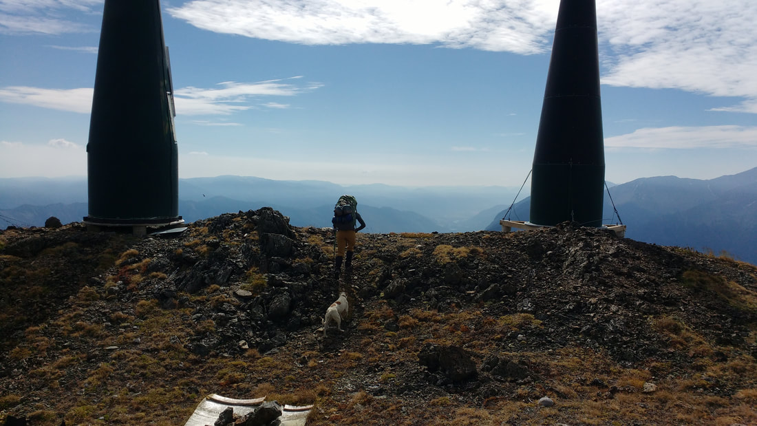
Eventually we reached the ridge below Mount Mclean where there was a small tarn down below us that looked like another great spot to camp. We continued on up the ridge and followed a neat goat path through some more exposed rocks to avoid the talus. at 1050 we were on top of Mount Mclean looking at all the interesting radio towers and peering down on Lillooet.
Eventually we reached the ridge below Mount Mclean where there was a small tarn down below us that looked like another great spot to camp. We continued on up the ridge and followed a neat goat path through some more exposed rocks to avoid the talus. at 1050 we were on top of Mount Mclean looking at all the interesting radio towers and peering down on Lillooet.
 |  Moon Lake |
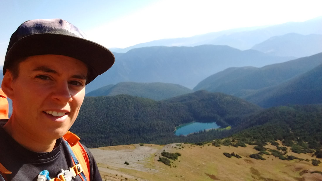
Mount Mclean
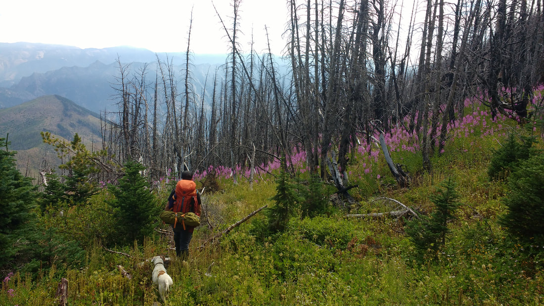
Here I was not entirely sure how to proceed. I knew that far below us lurked an uninviting burn that we would need to navigate before reaching 8kms of gravel road that led back home. We dropped off Mission Ridge for the final time and started to enter a slight forest. We ended up right in an old slide and moonwalked our way down sliding gravel. It was a bit alarming and steep, but also kind of fun.
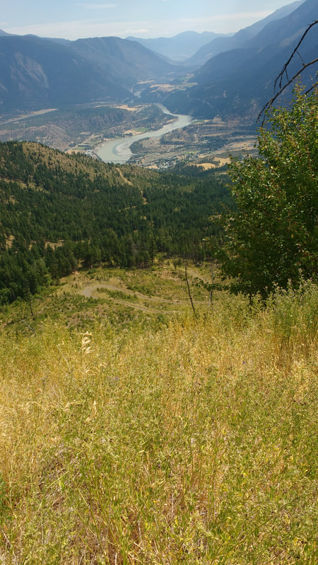
It wasn't long until we hit the burn. However it looked like a short distance down to the road. The burn enticed us at first. Minimal white-grey burned trees here and there and beautiful purple fireweed up to the knees. The contrast was stunning. However, our meander downhill turned into a class 5 bushwhack of epic proportions with fireweed up past our heads mixed with thick prickle bushed and other shrubs. Down at our feel lay hundreds of dead trees all over the ground that we could not see. We tripped, stumbled, and slid our way down to the road. What looked like a 20min hike took us an hour only to finally reach the top of a road a long way from home.
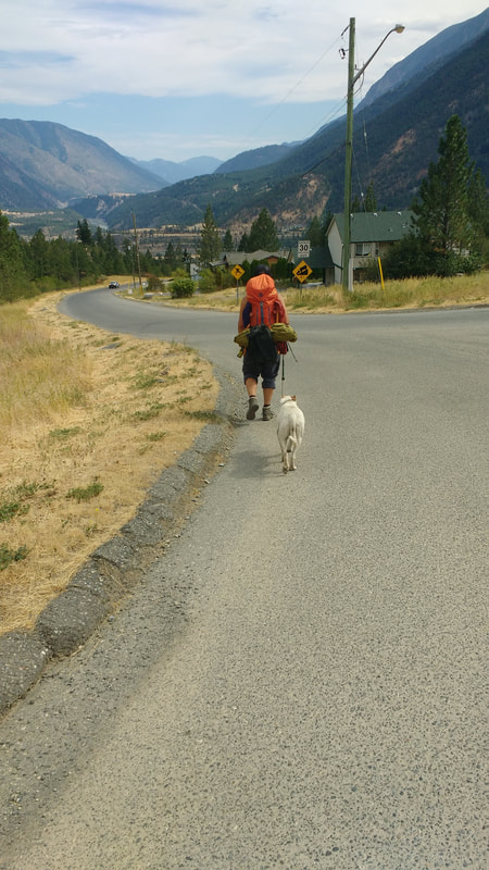
At this point we were spent. It was hot, we were filthy, and our feet were sore. We had a small break to drink water and have a snack before carrying on. It was around 1330. The road was a welcome friend, but we sill had a long way to go. Down, down, down, and more down on sore feet before reaching the top of the TBird Reserve. We kept walking down Scotchman Rd and back home despite some weird stares from people passing by. We collapsed on our front patio around 1540.
I would love to do this again with a better exit plan! Don't forget to hike up your life!
It wasn't long until we hit the burn. However it looked like a short distance down to the road. The burn enticed us at first. Minimal white-grey burned trees here and there and beautiful purple fireweed up to the knees. The contrast was stunning. However, our meander downhill turned into a class 5 bushwhack of epic proportions with fireweed up past our heads mixed with thick prickle bushed and other shrubs. Down at our feel lay hundreds of dead trees all over the ground that we could not see. We tripped, stumbled, and slid our way down to the road. What looked like a 20min hike took us an hour only to finally reach the top of a road a long way from home.
At this point we were spent. It was hot, we were filthy, and our feet were sore. We had a small break to drink water and have a snack before carrying on. It was around 1330. The road was a welcome friend, but we sill had a long way to go. Down, down, down, and more down on sore feet before reaching the top of the TBird Reserve. We kept walking down Scotchman Rd and back home despite some weird stares from people passing by. We collapsed on our front patio around 1540.
I would love to do this again with a better exit plan! Don't forget to hike up your life!
 |  |
 RSS Feed
