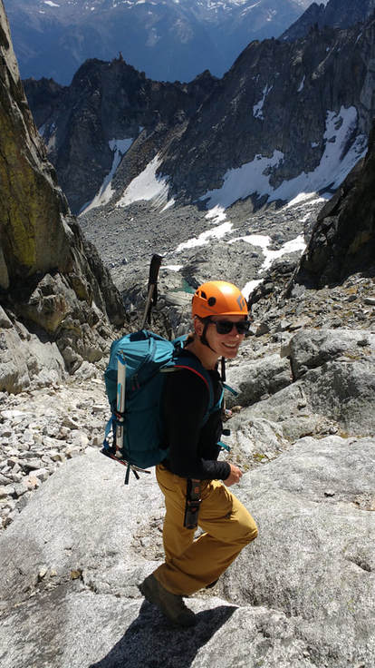
My first time visiting Gold Bridge was last summer. I recall seeing two large mountains that I knew I would need to summit one day. The first being Mount Sloan, which is a 2720m peak that I first viewed from Gun Lake while sipping a cold beer on a friend's dock. The Jagged summit of Sloan dominates the horizon to the south. It is in the Matt Gun 'Scrambles' book. The second summit was Mount Truax, the highest summit in the Bendor Range at 2875m. Best viewed from Tyaughton Lake from the patio of Tyax Resort. Our plan was to spend two days bagging these peaks back-to-back as day trips. I knew that both were going to be long days, but we love punishment.
Mount Sloan
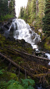 Waterfall in the middle of the bushwhack
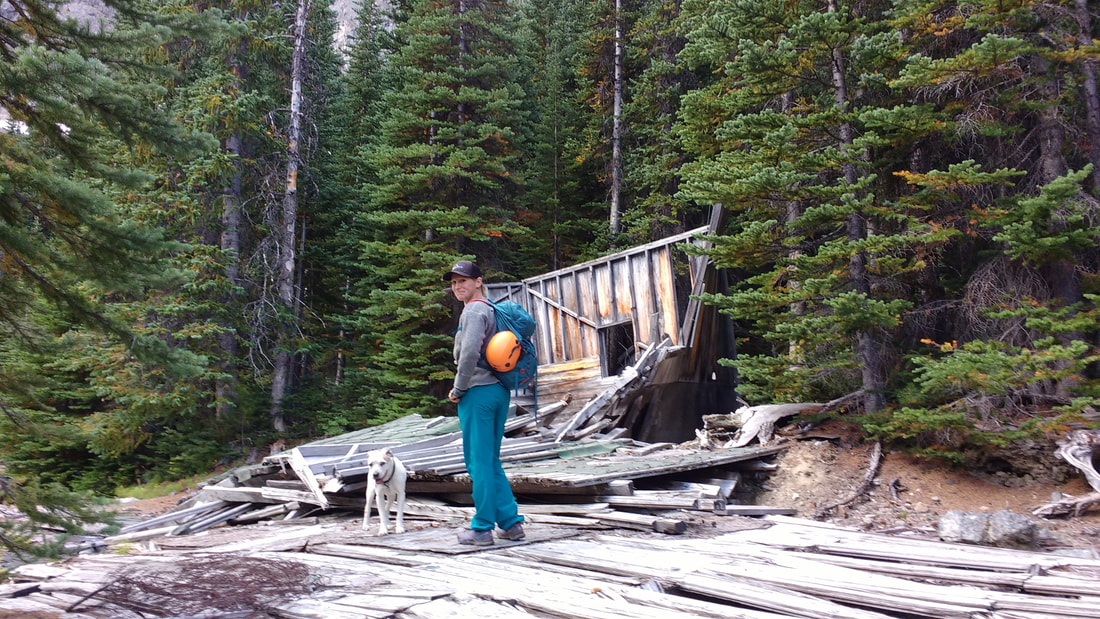
 The first peak we bagged was Mount Sloan. Route planning was straightforward since there are solid instructions in the Matt Gun 'Scrambles' book. The road on the approach had a number of cross-ditches, but nothing my tacoma couldn't handle. It also became quite grown in so we didn't quite make it to the end of the road.
We started hiking later then I would have liked and didn't leave the truck until around 0900. We followed some flagging off the end of an old logging setting that headed into the bush to the right (this was the wrong way, there is a more booted trail to the left). There wasn't much of a booted path, which I anticipated, and we quickly arrived at a creek mentioned in the book. We found a safe log to cross and then lost the flagging and evidence of a route. Regardless we carried on, knowing that the creek flowed out of a lake above us that we needed to get to. Here we came across a neat waterfall. The bush was impressively thick and very difficult to travel through. Luckily we didn't need to go far and popped out at the first lake.
We started hiking later then I would have liked and didn't leave the truck until around 0900. We followed some flagging off the end of an old logging setting that headed into the bush to the right (this was the wrong way, there is a more booted trail to the left). There wasn't much of a booted path, which I anticipated, and we quickly arrived at a creek mentioned in the book. We found a safe log to cross and then lost the flagging and evidence of a route. Regardless we carried on, knowing that the creek flowed out of a lake above us that we needed to get to. Here we came across a neat waterfall. The bush was impressively thick and very difficult to travel through. Luckily we didn't need to go far and popped out at the first lake.
First Lake
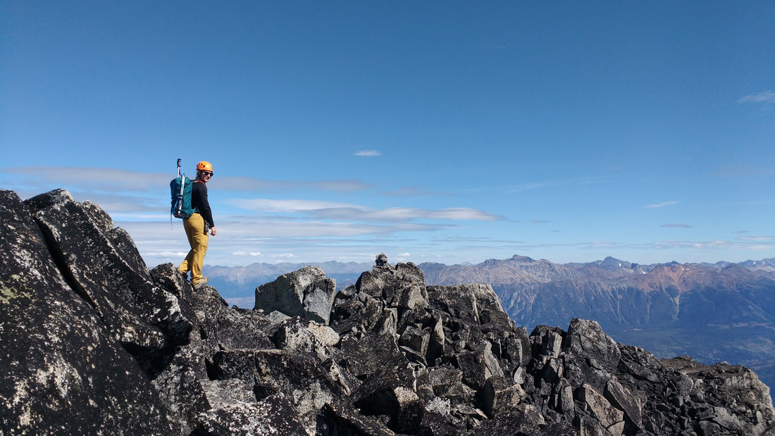
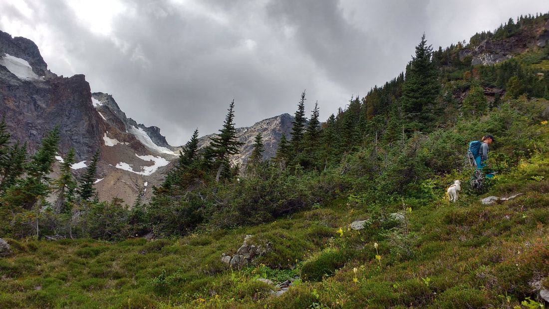
Once at the lake we thrashed around a while longer and finally picked up the flagged path and faint trail on the east side of the lake. At the far end we saw plenty of bear tracks. The trail now followed a creek and the instructions told us to wait for a fork in the creek to cross over and start heading up towards the base of Sloan. We ended up wandering right passed our turn, but it didn't matter. We headed up another spot when I realized our error and ended up a the second lake without difficulty.
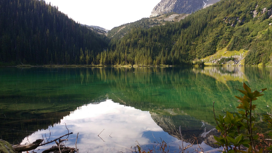
It was 1100 by this point and the lake here was a stunning turquoise It looked like a really great spot to camp. Lots of flat soft ground. At this point we started up the loose gravel and boulders below the summit block, slightly hugging the right side. We eventually made our way up to find the Matt Gun scrambler's gully. I had read many trip reports of people accidentally taking the wrong one and getting foiled. I hoped this would not be the case for us.
It was 1100 by this point and the lake here was a stunning turquoise It looked like a really great spot to camp. Lots of flat soft ground. At this point we started up the loose gravel and boulders below the summit block, slightly hugging the right side. We eventually made our way up to find the Matt Gun scrambler's gully. I had read many trip reports of people accidentally taking the wrong one and getting foiled. I hoped this would not be the case for us.
Second Lake
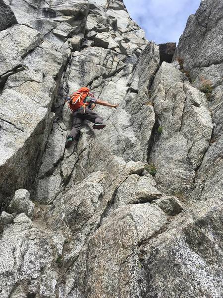 The crux | 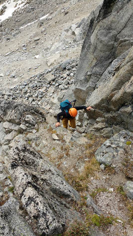 |
After some searching and reasoning we found a small step that looked to be the crux below a gully with a small carn. This must be the way. It was 1140. I pulled up my big girl panties, strapped on a helmet, and climbed up the step. It was only very slightly scary, but short. Maybe like one 5.7 move? 10 feet of climbing and you are in a steep, bouldery gully.
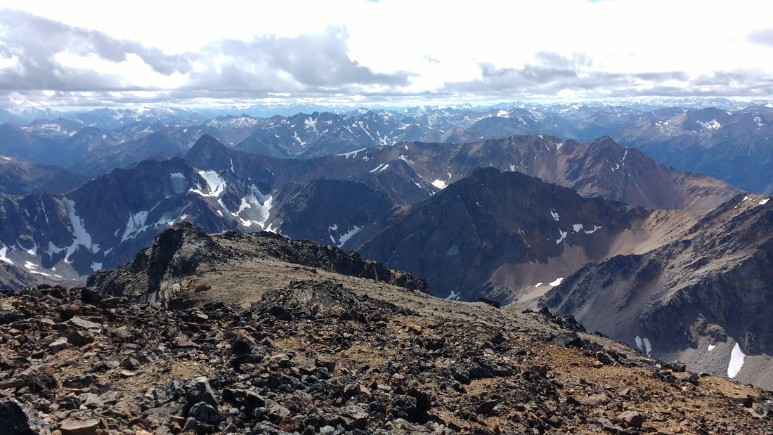
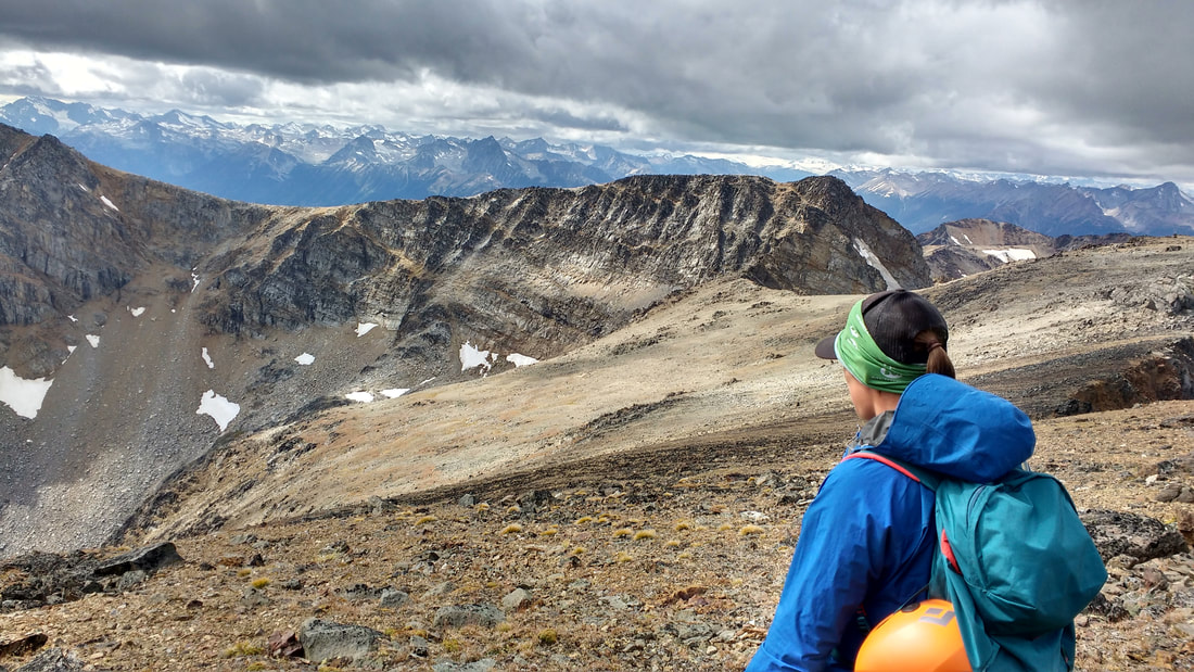
The progress in the gully slowed down considerably due to steepness, exposure, and scrambling up loose boulders and rocks. Let me tell you though, the views were amazing! The endless mountains of the Bridge River Valley started to unfold before us framed by the jagged rocks protruding from the flanks of Sloan.
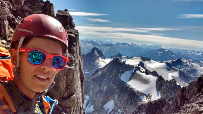
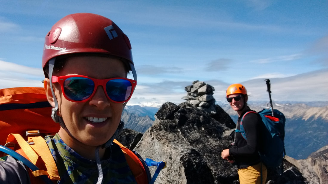
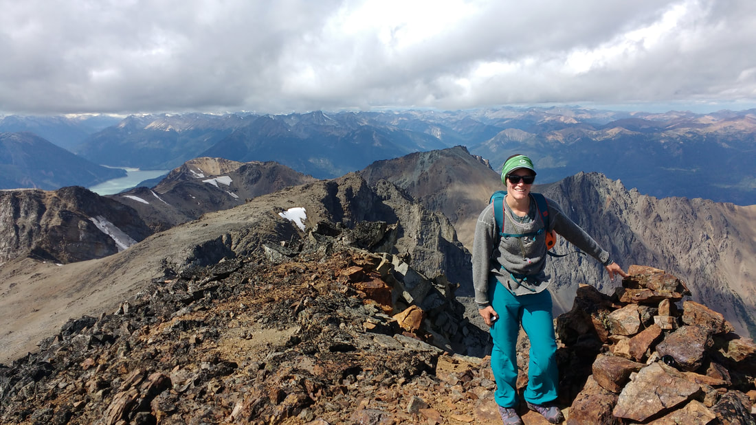
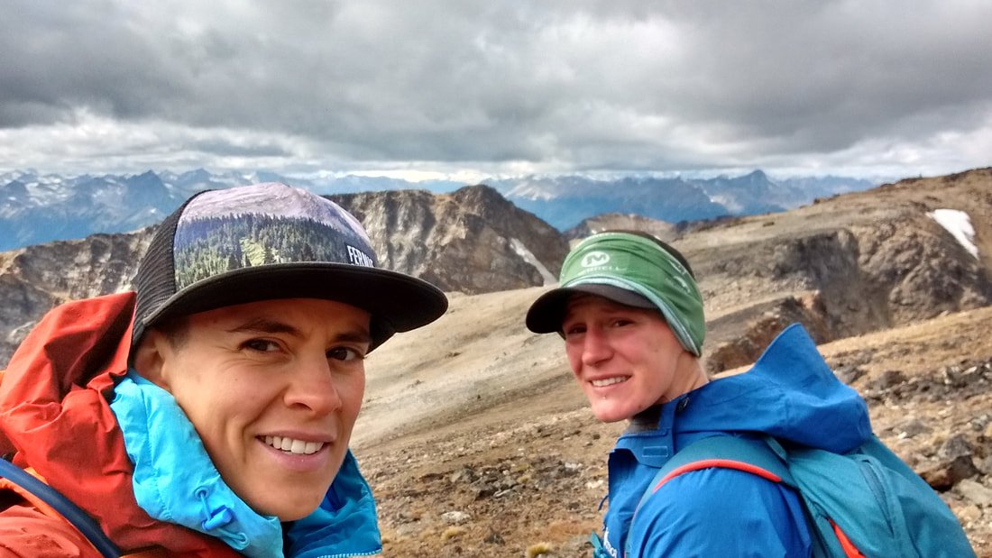
We popped out at the top of the gully and hopped on massive boulders, which I prayed were not loose. We hit the summit at 1330 and had a good rest and some snacks. The view was breathtaking. The entire area opened up. Mountain peaks as far as I could see.
The progress in the gully slowed down considerably due to steepness, exposure, and scrambling up loose boulders and rocks. Let me tell you though, the views were amazing! The endless mountains of the Bridge River Valley started to unfold before us framed by the jagged rocks protruding from the flanks of Sloan.
We popped out at the top of the gully and hopped on massive boulders, which I prayed were not loose. We hit the summit at 1330 and had a good rest and some snacks. The view was breathtaking. The entire area opened up. Mountain peaks as far as I could see.
After a relatively short rest we headed back down, which was less scary then I imagined. We took it slow in the gully since a fall would have been fatal. After what seemed like no time at all we were back at the first lake. I was really hoping to find a better way down since the way up was a nasty whack. To our luck we did find one. A fairly nice fagged path that shot off to the right of the lake. It stayed up rather high and seemed to be taking us high above and passed the truck, but this was not the case. In fact it spat us out right where we started in the logging setting, but more to the eat side of the road.
Our total time here was 7.5 hours. 4.5 up and 3 down including breaks. We finished off the day with beers on the deck of Tyax Resort.
Our total time here was 7.5 hours. 4.5 up and 3 down including breaks. We finished off the day with beers on the deck of Tyax Resort.
Mount Truax
The next mountain goal was Mount Truax. This one was slightly more tricky regarding the approach. It is a mountain not frequently travelled with only a few trip reports from various routes, but not from the one I had my eyes on. I had looked on google earth and saw that Truax Creek FSR ran to the east side of the mountain and provided easyish access to the south aspect of the summit, which appeared to be an easy walk up. The only issue was getting details on how far Truax Creek FSR could be driven. I talked to a local that said we could drive about 9kms and then bike the remaining 5kms to the end of the road. That sounded pretty good.
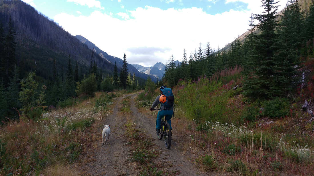
We set off again rather late around 0900. The drive on the road was not bad at all, but took some time. The bike ride portion was quite easy and a gentle incline for the most part with a few deep cross-ditches and creeks. Here there was a ton of bear tracks and scat. We talked and sang loudly to make our presence known.
We set off again rather late around 0900. The drive on the road was not bad at all, but took some time. The bike ride portion was quite easy and a gentle incline for the most part with a few deep cross-ditches and creeks. Here there was a ton of bear tracks and scat. We talked and sang loudly to make our presence known.
The road was an easy grade, and after about 5kms we hit the end of Truax FSR and hid the bikes. From the end of the road we picked up a sparsely flagged route that seemed to head in the correct direction and crossed a couple streams in a marshy area. We hit an old mining road and continued south. We passed an old cabin that was in shambles and took note of a few mine shafts visible in the side of the mountain to our left.
Old mining cabin
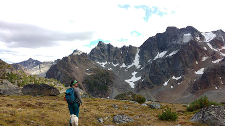
The old mining road ran up to the shafts that disappeared into the mountains so we knew we would be navigating the rest of the trip. We took a turn to the west, hopping boulders along the edge of a creek. As we continued along we again noticed a piece of flagging on the other side of the creek. I assumed this must be a good place to cross and start making our way north to the upper bowl below the true summit. The going was easy through small trees and meadows. In short order we popped out into the bowl below the summit.
This area was very beautiful. It felt like we were on another planet. From here I eyed the GPS and a map I had. I knew that it would be a nasty hike up a loose talus slope to bag the summit. We picked what looked like the easiest way and slowly made our way up. It was extremely slow going, but exposure wasn't bad.
This area was very beautiful. It felt like we were on another planet. From here I eyed the GPS and a map I had. I knew that it would be a nasty hike up a loose talus slope to bag the summit. We picked what looked like the easiest way and slowly made our way up. It was extremely slow going, but exposure wasn't bad.
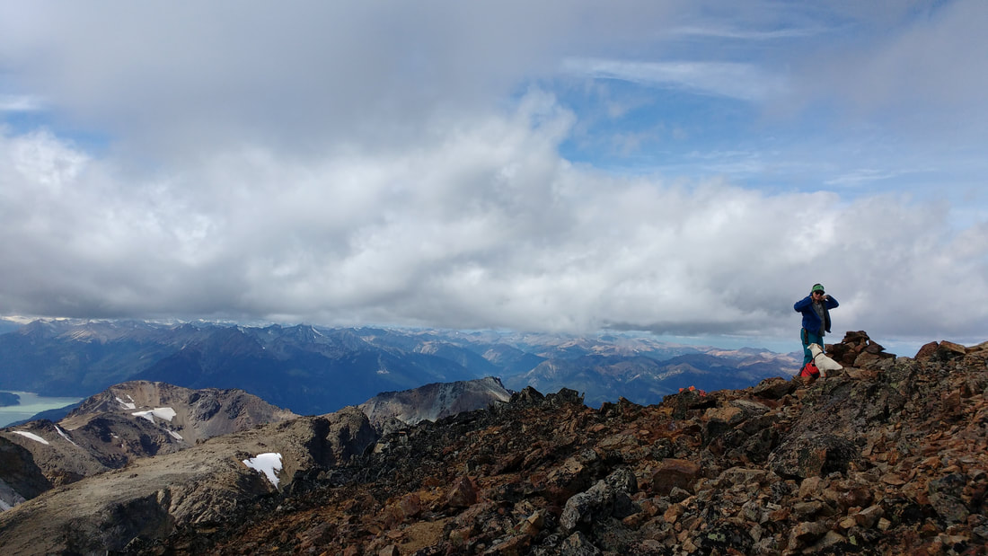
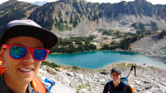
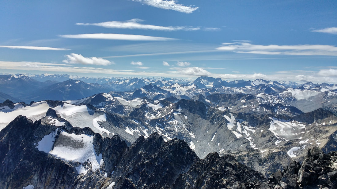
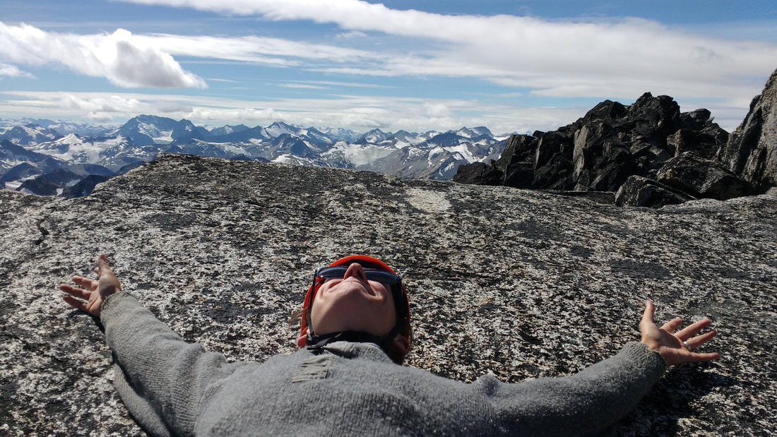
Eventually we gained the ridge and views of the surrounding area began to unfold. We could see a large radio tower on one of the summits to the west. Once on the ridge the summit was a relatively short walk to the east. At 1320 we arrived. The wind was blowing hard, but we slapped on warm jackets and hunkered down with a snack. We took a relatively short break to take in the view and signed the summit register. The last person to sign was in 2015.
 | 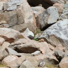 Ptarmigan |
The hike down was mainly uneventful. However, we did see a number of ptarmigans in the alpine bowl and a curious martin staking claim over a pika burrow. We hopped on our bikes back at the road an enjoyed the downhill coast back to the truck. We finished the hike around 1630. We would have been faster, but had to wait for our dog on the bike ride down. It was another long day, but a great summit success.
 RSS Feed
