"Best bang for your buck for getting into the alpine"
It is February 2015 and we have finally done our first solid day trip of the year, and a good one at that. The weather has been unbelievable for this time of year: hardly any snow in the alpine and temperatures above 10 degrees. Kind of sad in a way because if this keeps up we will have very little drinking water for hikes in the summer and swimming holes will shrink into muddy swamps... Nevertheless, Darryl, our pal Jake, and I took advantage of this wonderful cloudless Sunday and hiked 5040 Peak in the Alberni-Clayquot area.
5040 Peak is 1532m high and is accessed by heading south on highway 4 from Port Alberni towards Tofino. We stayed at our buddy Jake's house on Sprout Lake the night before the hike and left his place just before 0800 in the morning. We started counting the kilometres once we passed the Sutton Pass sign on the highway, which is almost exactly 5kms to the left turn on Marion Main. 6 kms after turning onto Marion Main we passed by the north west approach up to 5040 (on the left of the road and indicated by flagging) and decided to carry on and access the Cobalt Lake route, which is another 3.9kms further.
5040 Peak is 1532m high and is accessed by heading south on highway 4 from Port Alberni towards Tofino. We stayed at our buddy Jake's house on Sprout Lake the night before the hike and left his place just before 0800 in the morning. We started counting the kilometres once we passed the Sutton Pass sign on the highway, which is almost exactly 5kms to the left turn on Marion Main. 6 kms after turning onto Marion Main we passed by the north west approach up to 5040 (on the left of the road and indicated by flagging) and decided to carry on and access the Cobalt Lake route, which is another 3.9kms further.
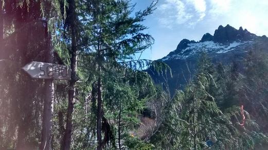
Small sign at the parking area
We reached the parking area on the road to find one other frosty truck left by someone who camped over night. There wasn't a cloud in the sky, the air was brisk, and there was a layer of frost on the ground. We were on the trail and heading up across the slash at exactly 0900. I have to admit that the trail is quite nice: well booted and flagged. Someone has definitely been out there with a chainsaw keeping the brush at bay. However, this trail does not mess around and immediately we were headed straight up into the bush and breathing hard.
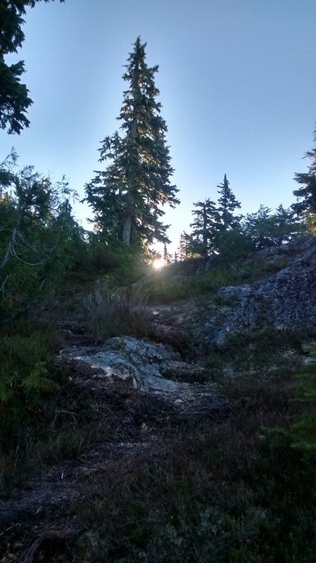 | 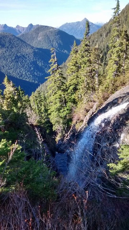 |
We followed the trail up with a creek to our left that occasionally provided beautiful views of little water falls coming down from Cobalt Lake. To our backs we had Triple Peak looming above us often visible to through the trees, and the sun was just barely coming over the mountain in front of us. The trail was definitely a bit frosty and icy, which called for careful footing.
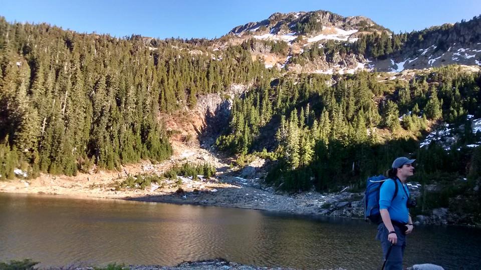
Cobalt Lake
 |  Testing the crampons |
I mentioned that 5040 is the best bang for your buck to reach the alpine because in almost exactly an hour we busted out of the trees and into the alpine at Cobalt Lake. We immediately were hit with a steady cool breeze, which almost prompted me to put on my sweater, but as we walked towards the east side of the lake it quickly disappeared and we could feel the heat of the sun. As we skirted the lake we noticed one solo tent, and I was a bit jealous that its inhabitant was able to take in what I imagine was a magnificent sun set last evening and beautiful starry night.
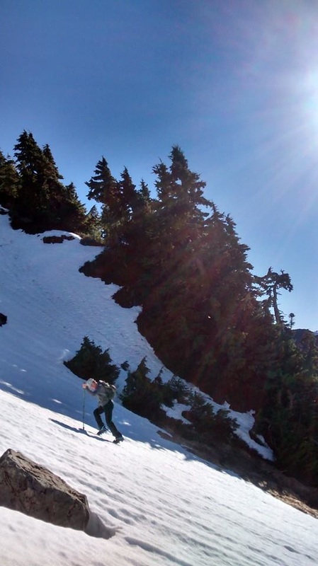
After the lake we headed up through another steeper and sightly treed section before popping out onto the rock and hard snow before the summit block. Here Darryl and I figured we would throw on our new crampons and test them out- even though they were not necessarily warranted. After about 5 minutes I took mine off because I did not take the time to adjust them properly and my feet were sliding around, which was a bit sketchy once the terrain steepened. However, Darryl carried on as you can see in the pictures and got the hang of it quite quick. Jake and I scrambled along on the rocks and grass beside her, which was slightly less efficient. At this point we ran into the owner of the frosty truck and tent we saw. He was hiking in track pants, a flannel shirt, and carrying a 3 foot long machete unsheathed in his hand.... Made me a tad nervous for both him (if he wiped out with that thing...) and us, yikes!
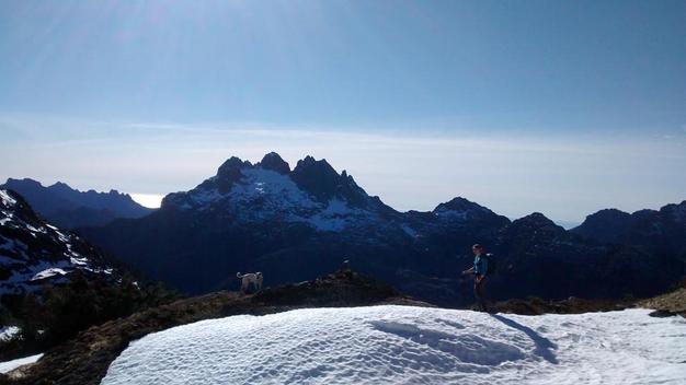
Once we met up directly under the summit block we talked about the two options to summit by either going directly up or swinging around to the west and climbing up the back side of the mountain. We decided that the direct route did not seem bad and headed right up. We definitely chose the path of most resistance and ended up clambering through snow wells, thick brush, and rock. The dog was not impressed and it took us much more time than what was necessary. Needless to say after 1.5 hrs from the lake and 3 hours from the truck we stumbled onto the top of the mountain and it was a sight to behold.
Once we met up directly under the summit block we talked about the two options to summit by either going directly up or swinging around to the west and climbing up the back side of the mountain. We decided that the direct route did not seem bad and headed right up. We definitely chose the path of most resistance and ended up clambering through snow wells, thick brush, and rock. The dog was not impressed and it took us much more time than what was necessary. Needless to say after 1.5 hrs from the lake and 3 hours from the truck we stumbled onto the top of the mountain and it was a sight to behold.
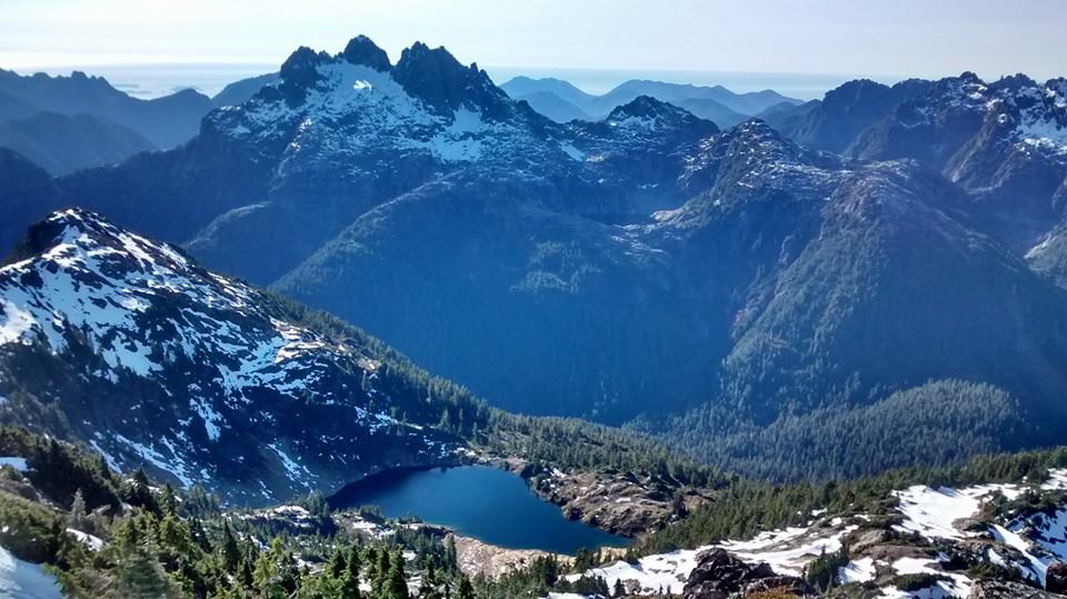
Money shot of Cobalt Lake and Triple Peak
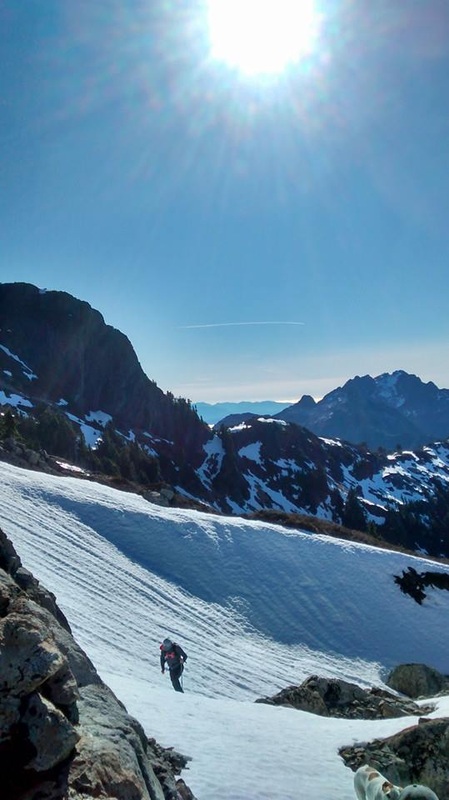
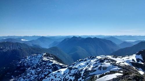
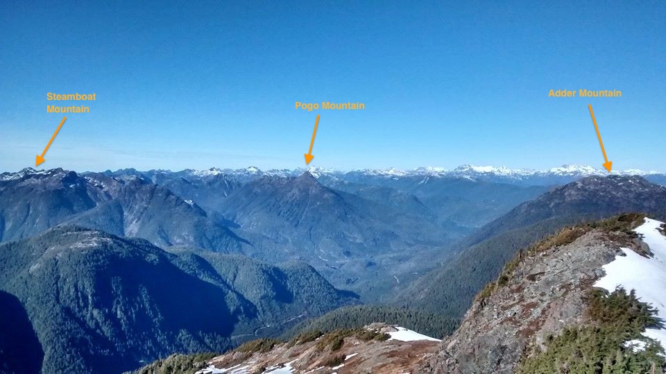
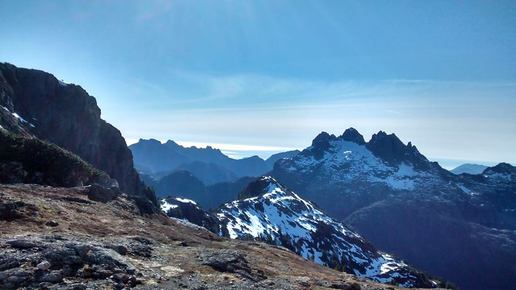
 | The view from the top of 5040 Peak was amazing in all directions. I have never done a hike other than in Victoria where I could see the pacific ocean, it was beautiful. The visibility was just perfect. While on the summit we met another guy from Courtenay who had hiked solo. When I pulled out the register to sign I noticed the previous entries were dated back in December. After about 30 mins of snacking and re-energizing we decided to make our way back down the trail. Of course, since our route up was not enjoyable, we decided to take the longer descent that heads down the west side of 5040 and wraps around to the east. This was less steep and easier going, but the hard icy snow proved to be an obstacle. To wrap around the mountain we passed above a snowy bowl that was cool looking, but would send a us off into oblivion if we fell. In the picture to the left I am standing in the middle of the bowl. My head is in the way (selfie), but you can see just how far it goes. |
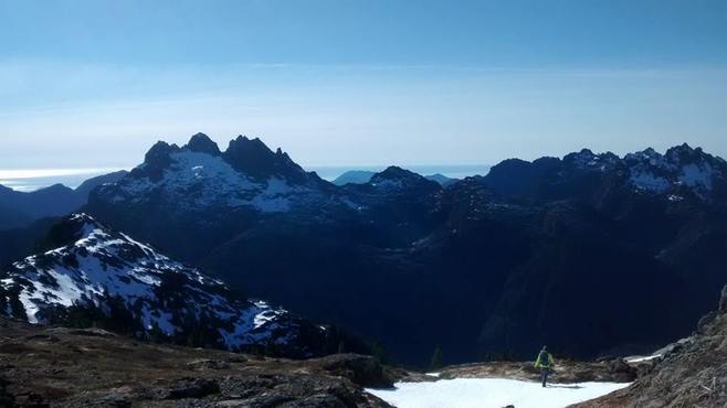
wrapping around to the east
Once we met back up with the east side of the mountain the snow was starting to melt slightly, which made it possible to make some foot holds. Thus, we were able to cross some snow, rather then skirting around, which made us a bit faster coming down. It felt like in no time we were back down at the lake and it was hot! The sun was beating down and I felt an urge to jump in the lake... I quickly reminded myself that it was FEBRUARY and carried on.
We made it back down to the truck just before 1500 - making our hike 6 hours round trip. I dipped my head into a mountain stream and we laid around in the road sipping beer and reminiscing about the views we had just taken in. This was my first hike in the Alberni-Clayquot area (closest being Arrowsmith) and I definitely plan on doing more!
We made it back down to the truck just before 1500 - making our hike 6 hours round trip. I dipped my head into a mountain stream and we laid around in the road sipping beer and reminiscing about the views we had just taken in. This was my first hike in the Alberni-Clayquot area (closest being Arrowsmith) and I definitely plan on doing more!
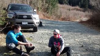 Relaxing back at the truck | 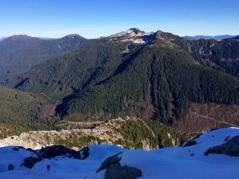 View from Triple Peak back at us on the same day by a fellow hiker Chris Istace |
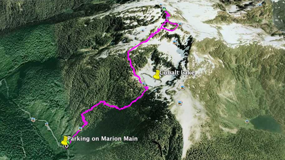
Our GPS track
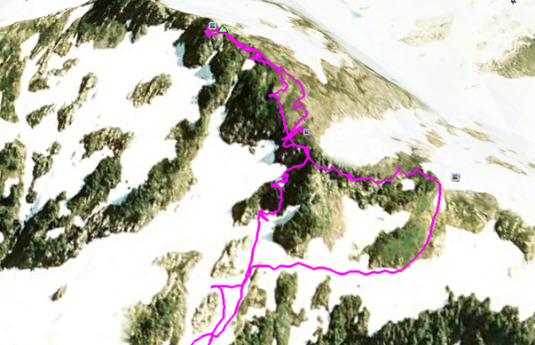
Our route up the summit block on the left and down to the right
| If you want the GPS track for the trip it is on the left. I suggest following our descent route instead of the ascent. Or else you can follow it directly below the summit and keep left. | ||
 RSS Feed
